

- Usage in publication:
-
- Jeffersonville member
- Modifications:
-
- First used
- Dominant lithology:
-
- Clay
- AAPG geologic province:
-
- South Georgia sedimentary province
- Piedmont-Blue Ridge province
Summary:
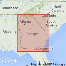
Jeffersonville member is a new name informally introduced in this report for the kaolin deposits in the upper part of the Huber Formation of the Oconee Group (new). The Oconee Group encompasses all of the pre-late Eocene kaolin deposits of fluvial origin in the Fort Valley plateau and Fall Line Hills districts of the GA Coastal Plain. The depositional environment of the new member is still in question. Further study may prove that the unit is not fluvial but coastal marine in origin and should be assigned to the Fort Valley Group rather than the Oconee. It is for this reason that the name is considered informal at this time. The Jeffersonville has previously been referred to as Claiborne kaolin. It consists mainly of distinctive pale greenish, hard, brittle kaolin with a hackly fracture. The trace fossil PLANOLITHES is common. Unit occurs from the vicinity of the Ocmulgee River in the west at least as far as Richmond Co., GA, in the east and is found well onto the Piedmont in Hancock Co., GA. Disconformably overlies the early Paleocene Marion Member (new) of the Huber Formation; disconformably underlies the Barnwell Group. The Jeffersonville is a stratigraphic equivalent of the coastal marine Mossy Creek and Perry Sands (both new) and the Lisbon Formation. Based on this stratigraphic position, the Jeffersonville is interpreted as late middle Eocene (late Claibornian, Bartonian).
Source: GNU records (USGS DDS-6; Reston GNULEX).
For more information, please contact Nancy Stamm, Geologic Names Committee Secretary.
Asterisk (*) indicates published by U.S. Geological Survey authors.
"No current usage" (†) implies that a name has been abandoned or has fallen into disuse. Former usage and, if known, replacement name given in parentheses ( ).
Slash (/) indicates name conflicts with nomenclatural guidelines (CSN, 1933; ACSN, 1961, 1970; NACSN, 1983, 2005, 2021). May be explained within brackets ([ ]).