The National Geologic Map Database is migrating to a new infrastructure. We apologize for any service disruptions during this process.
|
|---|


- Usage in publication:
-
- Jayuya Tuff*
- Modifications:
-
- Named
- Dominant lithology:
-
- Tuff
- Mudstone
- Sandstone
- AAPG geologic province:
-
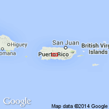
- Caribbean region
Summary:
The Jayuya Tuff, here named, consists of massive, coarse-grained, dark-green crystal tuff and lapilli tuff with lenses of mudstone and sandstone. South of the Utuado batholith the rocks are pyritized, epidotized, and hydrothermally altered. Lower part of the Jayuya is cut out by the batholith; conformably underlies the Robles Formation. Thickness is 600 to 900 m. Age is Early Cretaceous. No fossils.
Source: GNU records (USGS DDS-6; Reston GNULEX).

- Usage in publication:
-
- Jayuya Tuff*
- Modifications:
-
- Overview
- AAPG geologic province:
-
- Caribbean region
Summary:
The Jayuya Tuff occurs in central Puerto Rico and consists of basaltic crystal-lithic tuff and fine-grained hyaloclastite, and subordinate silicified mudstone and volcanic sandstone. Locally metamorphosed to feldspar hornblende hornfels, gneiss, and schist. Maximum estimated thickness is 900 meters. The Jayuya is of Cretaceous(?) age.
Source: GNU records (USGS DDS-6; Reston GNULEX).
For more information, please contact Nancy Stamm, Geologic Names Committee Secretary.
Asterisk (*) indicates published by U.S. Geological Survey authors.
"No current usage" (†) implies that a name has been abandoned or has fallen into disuse. Former usage and, if known, replacement name given in parentheses ( ).
Slash (/) indicates name conflicts with nomenclatural guidelines (CSN, 1933; ACSN, 1961, 1970; NACSN, 1983, 2005, 2021). May be explained within brackets ([ ]).