The National Geologic Map Database is migrating to a new infrastructure. We apologize for any service disruptions during this process.
|
|---|


- Usage in publication:
-
- Jarvis Church conglomerate member
- Modifications:
-
- Original reference
- Dominant lithology:
-
- Chert
- Conglomerate
- Sandstone
- Shale
- AAPG geologic province:
-
- Chautauqua platform
Summary:
Pg. 110-111, pl. 1. Jarvis Church conglomerate member of Konawa formation. Name applied to multicolored cherts that occur about 250 feet above base of formation. Member is a single bed about 10 feet thick. Cross-bedding and torrent bedding are common; uppermost horizon is clay pebble conglomerate which grades upward into thin cross-bedded sandstone, thin limy sandstone, or marl-like shale. Age is Permian.
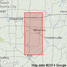
Typically developed near Jarvis Church, in sec. 23, T. 10 N., R. 5 E., Seminole Co., east-central OK.
Source: US geologic names lexicon (USGS Bull. 1200, p. 1913).
For more information, please contact Nancy Stamm, Geologic Names Committee Secretary.
Asterisk (*) indicates published by U.S. Geological Survey authors.
"No current usage" (†) implies that a name has been abandoned or has fallen into disuse. Former usage and, if known, replacement name given in parentheses ( ).
Slash (/) indicates name conflicts with nomenclatural guidelines (CSN, 1933; ACSN, 1961, 1970; NACSN, 1983, 2005, 2021). May be explained within brackets ([ ]).