

- Usage in publication:
-
- Jardine basalt
- Modifications:
-
- Original reference
- AAPG geologic province:
-
- Montana folded belt
Summary:
Pg. 16-17, pl. 4. Jardine basalt. "Basalt" exposed at summit of minor peak which is composed of Precambrian schist. Exposure is weathered brown. Rock is metamorphosed. Degree of metamorphism comparable to that exhibited by the schist, so that locally the rock is true schist, and elsewhere, where intimately penetrated by silica, is fine-textured gneiss. Rock probably represents an ancient basic intrusion in old metamorphic rocks, because Paleozoic formations show no such metamorphism. Age is pre-Paleozoic.
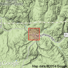
Notable exposures: caps mountain on east side of Bear Gulch ("Bear Creek" of Yellowstone folio), just east of town of Jardine, southwestern MT. Lies at altitude of about 8,400 feet.
Source: US geologic names lexicon (USGS Bull. 1200, p. 1909).
For more information, please contact Nancy Stamm, Geologic Names Committee Secretary.
Asterisk (*) indicates published by U.S. Geological Survey authors.
"No current usage" (†) implies that a name has been abandoned or has fallen into disuse. Former usage and, if known, replacement name given in parentheses ( ).
Slash (/) indicates name conflicts with nomenclatural guidelines (CSN, 1933; ACSN, 1961, 1970; NACSN, 1983, 2005, 2021). May be explained within brackets ([ ]).