

- Usage in publication:
-
- Jameson shale member*
- Modifications:
-
- Original reference
- Dominant lithology:
-
- Shale
- AAPG geologic province:
-
- Northern Coast Range province
Summary:
Pg. 17 (table 3), 62-64. Jameson shale member of Markley sandstone (Markley sandstone not adopted by the USGS). Consists of light-creamy-white to tan thinly laminated siliceous and sandy shales, often paper shales. Thickness 200 to 1,200 feet. Base of shale about 1,400 feet above base of Markley; both top and base of Jameson are gradational into sandstone. Age is Eocene.
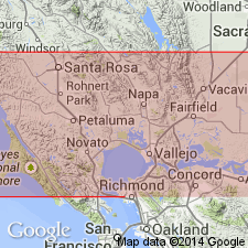
Named from Jameson Canyon in Carquinez quadrangle, north of San Francisco Bay. Occupies a single area between Elkhorn Peak and Napa Junction, Napa Co., northwestern CA.
[Misprint (US geologic names lexicon, USGS Bull. 1200, p. 1909): Weaver's GSA Memoir 35 was published in 1949, not 1941.]
Source: US geologic names lexicon (USGS Bull. 1200, p. 1909).
For more information, please contact Nancy Stamm, Geologic Names Committee Secretary.
Asterisk (*) indicates published by U.S. Geological Survey authors.
"No current usage" (†) implies that a name has been abandoned or has fallen into disuse. Former usage and, if known, replacement name given in parentheses ( ).
Slash (/) indicates name conflicts with nomenclatural guidelines (CSN, 1933; ACSN, 1961, 1970; NACSN, 1983, 2005, 2021). May be explained within brackets ([ ]).