

- Usage in publication:
-
- James Run Gneiss*
- Modifications:
-
- Original reference
- Dominant lithology:
-
- Amphibolite
- Gneiss
- AAPG geologic province:
-
- Piedmont-Blue Ridge province
Summary:
Pg. 4-5. James Run Gneiss. Consists of interlayered quartz amphibolite and biotite-quartz-plagioclase gneiss. Conformably overlies garnet schist that closely resembles part of Wissahickon Formation, which in turn overlies bedded microcline-mica gneiss that is much like part of Setters Formation. Sequence is separated from main belt of Glenarm metasedimentary rocks by broad belt of younger plutons, across which correlation is uncertain at best. Similarly, greenstones and schistose felsites of southern Cecil County, Maryland, which have been called "Cecil volcanics" or "Cecil County volcanic complex" (Marshall, 1937, Maryland Geol. Survey, v. 13) are surrounded by younger intrusive rocks, and their stratigraphic relation to known formations of Glenarm Series is largely a matter of conjecture. Proposed that James Run Gneiss and the volcanic complex of Cecil County not be included formally in Glenarm Series at present time. Age is Precambrian(?).
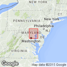
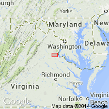
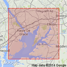
Named from exposures along James Run, southeastern Harford Co., northeastern MD.
Source: US geologic names lexicon (USGS Bull. 1350, p. 367).
- Usage in publication:
-
- James Run Gneiss*
- Modifications:
-
- Principal reference
- Revised
- Dominant lithology:
-
- Gneiss
- Amphibolite
- AAPG geologic province:
-
- Piedmont-Blue Ridge province
Summary:
Pg. 45-55; geol. map, 1968. James Run Gneiss of Glenarm Series. Thick-bedded, light-gray biotite-quartz-plagioclase gneiss with thin beds of quartz amphibolite grading downward into a sharply layered gneiss composed of sub-equal amounts of biotite-quartz-plagioclase gneiss and quartz amphibolite. Total thickness unknown, possibly 2,000 to 5,000 feet. Lithologically similar to Baltimore paragneiss. A volcaniclastic origin is inferred. Included in Glenarm Series. Age is considered Precambrian(?).
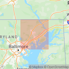
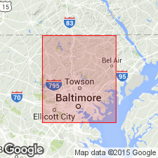
Type locality: Gatch quarry, on James Run Road about 2.3 mi south of Churchville, [Bel Air 7.5-min quadrangle], Harford Co., northeastern MD.
Source: Publication.
- Usage in publication:
-
- James Run Formation*
- Modifications:
-
- Revised
- Age modified
- AAPG geologic province:
-
- Piedmont-Blue Ridge province
Summary:
Gilpins Falls Member of James Run Formation named in this report. Age of James Run and its new member changed to Cambrian.
Source: GNU records (USGS DDS-6; Reston GNULEX).
- Usage in publication:
-
- James Run Formation*
- Modifications:
-
- Revised
- Age modified
- AAPG geologic province:
-
- Piedmont-Blue Ridge province
Summary:
Name of James Run Gneiss changed to James Run Formation. James Run made uppermost formation of Glenarm Series in Susquehanna River and central Maryland Piedmont areas, overlying Wissahickon Formation. Includes former Relay Quartz Diorite of Knopf and Jonas (1929), James Run Gneiss of Southwick and Fisher (1967), Baltimore paragneiss and Baltimore Gabbro of Hopson (1964), and Baltimore Gneiss dome of Southwick and Owens (1968). Age now considered to be Late Cambrian to Late Ordovician.
Source: GNU records (USGS DDS-6; Reston GNULEX).
- Usage in publication:
-
- James Run Formation*
- Modifications:
-
- Age modified
- AAPG geologic province:
-
- Piedmont-Blue Ridge province
Summary:
Age of James Run Formation changed to Early Cambrian.
Source: GNU records (USGS DDS-6; Reston GNULEX).
- Usage in publication:
-
- James Run Formation
- Modifications:
-
- Revised
- AAPG geologic province:
-
- Piedmont-Blue Ridge province
Summary:
James Run Formation, at Baltimore, MD, is here subdivided into Carroll Gneiss Member (new), Druid Hill Amphibolite Member (new), and Relay Gneiss Member (revised). Age shown as Cambrian(?).
Source: GNU records (USGS DDS-6; Reston GNULEX).
- Usage in publication:
-
- James Run Formation*
- Modifications:
-
- Revised
- Age modified
- AAPG geologic province:
-
- Piedmont-Blue Ridge province
Summary:
James Run Formation subdivided into eight members (ascending): Principio Furnace Member (new), equivalent Little Northeast Creek (new) and Frenchtown Members, Gilpins Falls Member, equivalent Big Elk Creek (new) and Principio Creek (new) Members, Happy Valley Branch Member (new), and an unnamed felsite member. Age changed from Early Cambrian to early Paleozoic. [Gilpins Falls and Big Elk Creek Members of James Run Formation are also present in DE (oral commun., Higgins (1979).]
Source: GNU records (USGS DDS-6; Reston GNULEX).
- Usage in publication:
-
- James Run Formation*
- Modifications:
-
- Age modified
- AAPG geologic province:
-
- Piedmont-Blue Ridge province
Summary:
Chopawamsic Formation and its probable correlative to the northeast in MD, the James Run Formation, are of Cambrian, possibly Early Cambrian, age based on discordant zircon data.
Source: GNU records (USGS DDS-6; Reston GNULEX).
For more information, please contact Nancy Stamm, Geologic Names Committee Secretary.
Asterisk (*) indicates published by U.S. Geological Survey authors.
"No current usage" (†) implies that a name has been abandoned or has fallen into disuse. Former usage and, if known, replacement name given in parentheses ( ).
Slash (/) indicates name conflicts with nomenclatural guidelines (CSN, 1933; ACSN, 1961, 1970; NACSN, 1983, 2005, 2021). May be explained within brackets ([ ]).