The National Geologic Map Database is migrating to a new infrastructure. We apologize for any service disruptions during this process.
|
|---|


- Usage in publication:
-
- Jackson's Gap Group
- Modifications:
-
- Named
- Dominant lithology:
-
- Phyllite
- Schist
- Quartzite
- AAPG geologic province:
-
- Piedmont-Blue Ridge province
Summary:
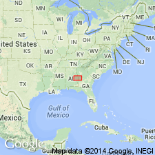
Jackson's Gap Group, defined here, is the old altered Wedowee of Adams (1926 and 1933) that borders the Archean igneous schist and gneiss on the 1926 Geologic Map of Alabama. Unit has been traced from near Atlanta, GA, southwestward to Elmore Co., AL. Consists principally of sericite-quartz phyllite, interlayered with graphitic schist and phyllite, graphitic metaquartzite, metaorthoquartzite, and local stretched-pebble conglomerate. Rocks are generally low to medium grade greenschist facies. Tallassee Metaquartzite described and assigned to Jackson's Gap at Stop 12. Unconformably overlies Heard Group. Apparent age from sericite is 318+/-10 m.y. [Age according to Alabama State Survey is middle Paleozoic.]
Source: GNU records (USGS DDS-6; Reston GNULEX).
- Usage in publication:
-
- Jacksons Gap Group
- Modifications:
-
- Overview
- Dominant lithology:
-
- Phyllite
- Schist
- Quartzite
- AAPG geologic province:
-
- Piedmont-Blue Ridge province
Summary:
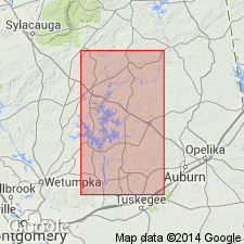
Brevard zone in AL contains a distinct lithostratigraphic sequence, the Jacksons Gap Group, a weakly deformed sequence of rocks lying between two deformation zones, the Katy Creek and Abanda faults. Johnson (1988: Auburn Univ. M.S. thesis) divided the Group into 7 mappable units, structurally ascending 1) cataclasites, derived in part from Kowaliga Gneiss; 2) Garnet-staurolite phyllonite; 3) locally graphitic micaceous quartzite; 4) interlayered graphite-muscovite quartzite and locally garnetiferous graphitic phyllonite/ schist; 5) sericite-chlorite phyllonite; 6) felsic porphyroclastic gneiss that grades into button schist or mylonite gneiss; and 7) quartz-sericite schist. Group thickens toward the northeast from Jacksons Gap, where it is 2,088 yds (1,909 m) thick. Southwest of Jacksons Gap, thickness and lithology of units vary slightly. Eagle Creek and Devils Backbone districts noted for minor gold production.
Source: GNU records (USGS DDS-6; Reston GNULEX).
- Usage in publication:
-
- Jacksons Gap Group
- Modifications:
-
- Areal extent
- Revised
- AAPG geologic province:
-
- Piedmont-Blue Ridge province
Summary:
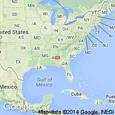
Lithologic units that compose the Jacksons Gap Group do not disappear beneath the Coastal Plain as previously thought, but can be mapped eastward around the hinge zone of the Tallassee synform where along the eastern limb they become the Loachapoka Schist of the Opelika Complex. The Loachapoka continues along the east limb of the synform into GA where it corresponds to the Sandy Springs thrust sheet of Higgins and others (1988). The Saugahatchee quartzite of the Loachapoka Schist, the Tallassee and Devils Backbone quartzites of the Jacksons Gap Group, and the Chattahoochee Palisades Quartzite are correlative. Authors suggest that the name Chattahoochee Palisades Quartzite be applied to these quartzites and further recommend that the schists of the Loachapoka and Jacksons Gap Group be referred to as the Factory Shoals Formation of the Sandy Springs Group.
Source: GNU records (USGS DDS-6; Reston GNULEX).
For more information, please contact Nancy Stamm, Geologic Names Committee Secretary.
Asterisk (*) indicates published by U.S. Geological Survey authors.
"No current usage" (†) implies that a name has been abandoned or has fallen into disuse. Former usage and, if known, replacement name given in parentheses ( ).
Slash (/) indicates name conflicts with nomenclatural guidelines (CSN, 1933; ACSN, 1961, 1970; NACSN, 1983, 2005, 2021). May be explained within brackets ([ ]).