- Usage in publication:
-
- Jack Creek Quartzite*
- Modifications:
-
- Named
- Dominant lithology:
-
- Quartzite
- Conglomerate
- AAPG geologic province:
-
- Northern Rocky Mountain region
Summary:
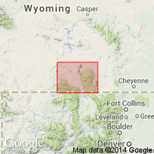
First used in a thesis as Jack Creek Formation. Named as basal formation Sierra Madre of Phantom Lake Metamorphic Suite for Jack Creek. Type section designated as exposures in Carrico Ranch area, sec 7, T15N, R87W, Carbon Co, WY, Northern Rocky Mountain region. Includes all metasedimentary rocks at base of Phantom Lake unconformably above Vulcan Mountain Metavolcanics (new) and below Silver Lake Metavolcanics (new) of Phantom Lake. Consists predominantly of white quartzite and lenses of gray and green phyllite, marble, paraconglomerate, quartz-pebble conglomerate, and metagraywacke 300-700 m thick. A 110 m thick pyritic and radioactive, quartz-pebble, dominant trough cross-bedded conglomerate at base named Deep Gulch Conglomerate Member. The overlying upper part of Jack Creek about 500 m thick consists of tabular planar cross-bedded arkosic, argillaceous or subargillaceous quartzite with abundant plagioclase, muscovite, and biotite locally with beds of phyllite and coarse-grained metacarbonate that has clastic detritus and is cross-bedded. Upper part has north-northeast paleocurrent direction. Quartzites in upper part are relatively clean, fine to medium grained and sericitic. Deposited probably on a shallow marine shelf under influence of tidal currents. Stratigraphic charts. Geologic map. Petrographic data. Of Late Archean age. Intruded by the 2,700 Ma Spring Lake Granodiorite.
Source: GNU records (USGS DDS-6; Denver GNULEX).
For more information, please contact Nancy Stamm, Geologic Names Committee Secretary.
Asterisk (*) indicates published by U.S. Geological Survey authors.
"No current usage" (†) implies that a name has been abandoned or has fallen into disuse. Former usage and, if known, replacement name given in parentheses ( ).
Slash (/) indicates name conflicts with nomenclatural guidelines (CSN, 1933; ACSN, 1961, 1970; NACSN, 1983, 2005, 2021). May be explained within brackets ([ ]).

