The National Geologic Map Database is migrating to a new infrastructure. We apologize for any service disruptions during this process.
|
|---|


- Usage in publication:
-
- Izee group
- Modifications:
-
- Original reference
- AAPG geologic province:
-
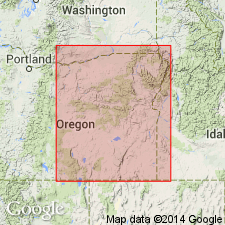
- Snake River basin
Summary:
Pg. 227 (table 1), 229, 255. Izee group. Consists of two noncalcareous formations, Hyde below and Snowshoe above (both new). Thickness 3,880 feet. Overlies Colpitts group (new); extends northeastward into Silvies River region, beveling both Colpitts and Mowich groups and lying discordantly upon Triassic strata; unconformably underlies Trowbridge shale (new). Age is Middle Jurassic.
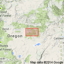
Type locality not stated. Widely exposed along Ochoco anticline from western end of Jurassic rock area northeastward across South Fork Valley and into west side of Bear Valley. Named from Izee Grange and Schoolhouse near South Fork River between Poison Creek and Rosebud Creek, Crook Co., east-central OR.
Source: US geologic names lexicon (USGS Bull. 1200, p. 1896).
- Usage in publication:
-
- Izee group†
- Modifications:
-
- [Abandoned]
- AAPG geologic province:
-
- Snake River basin
Summary:
Pg. 13. [†Izee Group considered abandoned.] Lupher (1941) proposed Izee Group and divided it into Hyde Formation and Snowshoe Formation; occurs along Ochoco anticline, extending from western end of Jurassic exposures northeastward across South Fork Valley into western Bear Valley, central Oregon. Beds assigned to the Hyde Formation by Lupher (1941) were reassigned to the Snowshoe Formation and underlying Mowich Group by Dickinson and Vigrass (1965), thus concept of Izee Group is no longer required.
See also Dickinson, W.R., and Vigrass, L.W., 1965, "Geology of the Suplee-Izee area, Cook, Grant, and Harney Counties, Oregon," Oregon Dept. Geol. and Min. Ind. Bull., no. 58, 109 p., geol. map (scale 1:42,000).
Source: Publication.
For more information, please contact Nancy Stamm, Geologic Names Committee Secretary.
Asterisk (*) indicates published by U.S. Geological Survey authors.
"No current usage" (†) implies that a name has been abandoned or has fallen into disuse. Former usage and, if known, replacement name given in parentheses ( ).
Slash (/) indicates name conflicts with nomenclatural guidelines (CSN, 1933; ACSN, 1961, 1970; NACSN, 1983, 2005, 2021). May be explained within brackets ([ ]).