- Usage in publication:
-
- Ison Branch Formation*
- Modifications:
-
- Named
- Dominant lithology:
-
- Tuff
- AAPG geologic province:
-
- Piedmont-Blue Ridge province
Summary:
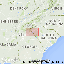
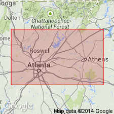
The Ison Branch Formation, at the base of the Clarkston slice in the Atlanta thrust sheet, is here named. It consists of metamorphosed, finely laminated, graphitic, calcareous and pyritic felsic tuff which weathers to a nearly white spongy saprolite. Structurally overlies the Stonewall Formation in the Stonewall slice of the Atlanta thrust sheet, and underlies the Barrow Hill Formation in the Clarkston slice with probable gradational contact. Thickness is a few hundred m. Age is Late Proterozoic to Early Ordovician(?).
Source: GNU records (USGS DDS-6; Reston GNULEX).

- Usage in publication:
-
- Ison Branch Formation*
- Modifications:
-
- Overview
- AAPG geologic province:
-
- Piedmont-Blue Ridge province
Summary:
Rocks mapped as unnamed fine-grained felsic gneiss in Six Mile thrust sheet are equivalent, at least in part, to Ison Branch Formation of Higgins and others (1988).
Source: GNU records (USGS DDS-6; Reston GNULEX).

- Usage in publication:
-
- Ison Branch Formation*
- Modifications:
-
- Age modified
- AAPG geologic province:
-
- Piedmont-Blue Ridge province
Summary:
Age of Ison Branch Formation of the allochthonous assemblage is changed to Late Proterozoic(?) to Middle Ordovician(?) based on a more conservative theory that the allochthonous rocks are 1) probably not older than Late Proterozoic because they are not part of Middle Proterozoic (Grenvillian) basement and 2) they could be as young, but not younger than, the time marking the beginning of closure of the ocean they originated in, as set by the slope reversal marked by deposition of Middle Ordovician Rockmart Slate upon unconformity at top of Upper Cambrian to Middle(?) Ordovician Knox Group and Middle Ordovician Lenoir Limestone. Report includes geologic map and correlation chart.
Source: GNU records (USGS DDS-6; Reston GNULEX).
For more information, please contact Nancy Stamm, Geologic Names Committee Secretary.
Asterisk (*) indicates published by U.S. Geological Survey authors.
"No current usage" (†) implies that a name has been abandoned or has fallen into disuse. Former usage and, if known, replacement name given in parentheses ( ).
Slash (/) indicates name conflicts with nomenclatural guidelines (CSN, 1933; ACSN, 1961, 1970; NACSN, 1983, 2005, 2021). May be explained within brackets ([ ]).

