

- Usage in publication:
-
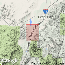
- Isom formation
- Modifications:
-
- Named
- Dominant lithology:
-
- Porphyry
- AAPG geologic province:
-
- Great Basin province
Summary:
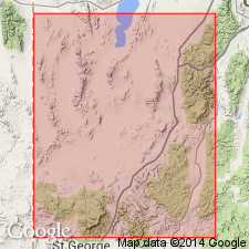
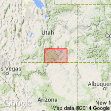
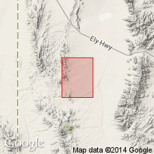
Named for Isom Creek. Type locality on south slope of east-west ridge north of Isom Creek, Three Peaks quad, sec 5, T35S, R12W, Iron Co, UT in Great Basin province. Rests on volcanic rocks of the Needles Range formation (new) or on older volcanic rocks of local origin. Divided into a lower unnamed ignimbrite a few tens of ft thick, a black to red-brown porphyry sheet of latitic composition named Baldhills member, and an upper purple-gray latite porphyry sheet named Hole-In-The-Wall member. Both named members are highly welded. Has some intercalated sedimentary rocks. The formation is 500 m thick at most places. Is widespread in the High Plateaus. Is older than the Quichapa formation (reduced in stratigraphic rank from group). Of Eocene or early Oligocene age.
Source: GNU records (USGS DDS-6; Denver GNULEX).
- Usage in publication:
-
- Isom formation
- Modifications:
-
- Areal extent
- AAPG geologic province:
-
- Great Basin province
Summary:
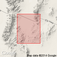
Extended into east and west White Mountain area, southeast Frisco 15' quad, Beaver Co, UT. Overlies Needles Range ignimbrite (Mackin, 1960). Underlies Quichapa ignimbrite (Mackin, 1960) in west White Mountain area; unconformably underlies andesite latites (middle to late Tertiary age) in east White Mountain area.
Source: GNU records (USGS DDS-6; Menlo GNULEX).
- Usage in publication:
-
- Isom formation
- Modifications:
-
- Areal extent
- AAPG geologic province:
-
- Great Basin province
Summary:
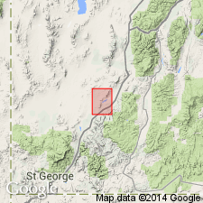
Extended into Red Hills and Parowan Gap areas of Iron Co, UT. Sketch maps show Oligocene age.
Source: GNU records (USGS DDS-6; Menlo GNULEX).
- Usage in publication:
-
- Isom formation
- Modifications:
-
- Areal extent
- AAPG geologic province:
-
- Great Basin province
Summary:
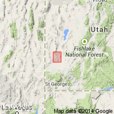
Extended to southern part of Wah Wah Mtns where Quichapa Formation overlies erosion surface cut into Hole-In-The-Wall Member of Isom Formation at Leighs Well. Assigned Tertiary age.
Source: GNU records (USGS DDS-6; Menlo GNULEX).
- Usage in publication:
-
- Isom Formation*
- Modifications:
-
- Revised
- Areal extent
- AAPG geologic province:
-
- Great Basin province
Summary:
Hole-In-The-Wall Tuff Member of Isom Formation herein adopted. Four small outcrops of member are mapped in secs.7 and 18 T37S R12W, Kanarraville 7.5' quad, Iron Co, UT. Exhibits compaction foliation resembling that in the Bauers Tuff Member (Quichapa Formation). Underlies Leach Canyon Member of Quichapa Formation. Overlies Claron Formation. Assigned Eocene or Oligocene age.
Source: GNU records (USGS DDS-6; Menlo GNULEX).
- Usage in publication:
-
- Isom Formation*
- Modifications:
-
- Overview
- AAPG geologic province:
-
- Great Basin province
Summary:
Named by Mackin (1960). Mapped undivided with Needles Range Formation. Overlies Needles Range Formation; underlies Quichapa Formation. Age is Eocene or early Oligocene.
Source: GNU records (USGS DDS-6; Menlo GNULEX).
- Usage in publication:
-
- Isom Formation*
- Modifications:
-
- Areal extent
- AAPG geologic province:
-
- Great Basin province
Summary:
Baldhills and Hole-In-The-Wall Members mapped in Needles Range (from approx. 38 deg 40' to 38 deg 15'N), Beaver and Millard Cos, UT. Baldhills Member which ranges from 30 to 35 ft thick, overlies Wah Wah Spring Member of Needles Range Formation near Indian Peak. Hole-In-The Wall Member which ranges from 15 to 25 ft. thick, overlies Baldhills Member near Indian Peak and Needles Range Formation elsewhere in study area. Hole-In-The-Wall Member is unconformably overlain by Quaternary alluvium. Isom Formation assigned Oligocene age.
Source: GNU records (USGS DDS-6; Menlo GNULEX).
- Usage in publication:
-
- Isom Formation*
- Modifications:
-
- Age modified
- AAPG geologic province:
-
- Great Basin province
Summary:
Map unit represents only Baldhills Tuff Member of Mackin (1960). Not adopted on basis of this GQ. Intensely welded tuff exposed in four small isolated outcrops. Unconformably underlies Holocene and Pleistocene breccia or Pliocene and Miocene(?) fanglomerate deposit. Unconformably overlies Straight Cliffs Formation (Late Cretaceous age) in northeast part of Cedar City quad, Iron Co, UT. Age of Isom Formation changed from Eocene or early Oligocene to: Oligocene or Miocene based on 25.0 +/-0.5 Ma K-Ar age (Armstrong, 1970, Geochemica et Cosmochimica Acta, v. 34).
Source: GNU records (USGS DDS-6; Menlo GNULEX).
- Usage in publication:
-
- Isom Formation*
- Modifications:
-
- Age modified
- AAPG geologic province:
-
- Great Basin province
Summary:
Age of Isom suggested as late Oligocene after Armstrong (1963) because of ages obtained from enclosing rocks. [Earlier change not made because formation mentioned in correlation only; Isom not present in Armstrong report].
Source: GNU records (USGS DDS-6; Menlo GNULEX).
- Usage in publication:
-
- Isom Formation*
- Modifications:
-
- Age modified
- Revised
- AAPG geologic province:
-
- Great Basin province
Summary:
Name applied (history of usage given) to dark crystal-poor volcanics above the Needles Range Formation, or locally the Claron Formation, and beneath Leach Canyon Formation in southwest Black Mountains, beneath Mount Dutton Formation in northern Black Mountains, and beneath Bear Valley Formation or Buckskin Breccia (new) on the Markagunt Plateau. Is divided into Baldhills Tuff and Hole-in-the Wall Tuff Members in the southwest Black Mountains; into Baldhills Tuff Member in the northern Black Mountains, and into Blue Meadows Tuff (new) and Baldhills Tuff Members, and a partially equivalent sandstone member on the Markagunt Plateau. These localities are in Iron Co, UT in the Great Basin province. Each member well described. Nomenclature chart; block diagram. Considered latest Oligocene or earliest Miocene on basis of K-Ar dates of 25.0 +/-0.4 m.y. to 27.2 m.y. published in earlier reports.
Source: GNU records (USGS DDS-6; Denver GNULEX).
- Usage in publication:
-
- Isom Formation*
- Modifications:
-
- Areal extent
- AAPG geologic province:
-
- Great Basin province
Summary:
Mapped in sec.1, T27S, R18W of Sawtooth Peak 7.5' quad, Beaver Co, UT. Consists of densely welded, vuggy, eutaxitic, vitric, latitic ash-flow tuff. Thickness approx. 20 ft. Unconformably overlies Lund Tuff Member of Needles Range Formation. Underlies Bauers Tuff Member of Condor Canyon Formation. Assigned Oligocene or Miocene age.
Source: GNU records (USGS DDS-6; Menlo GNULEX).
- Usage in publication:
-
- Isom Formation*
- Modifications:
-
- Areal extent
- AAPG geologic province:
-
- Great Basin province
Summary:
Mapped in Halfway Summit 7.5' quad, Millard and Beaver Cos, UT. Consists of densely welded, vuggy, eutaxitic, vitric, ash-flow tuff. Thickness about 20 ft. Underlies Bauers Tuff Member of Condor Canyon Formation; unconformably overlies Lund Member of Needles Range Formation. Assigned Oligocene or Miocene age.
Source: GNU records (USGS DDS-6; Menlo GNULEX).
- Usage in publication:
-
- Isom Formation*
- Modifications:
-
- Areal extent
- AAPG geologic province:
-
- Great Basin province
Summary:
Extended to Mineral Mountain, Washington Co, UT, where the "basal vesicular flow member" is exposed along west side of Butcher Knife Canyon. Consists of several flows of andesite, the lower flows being porphyritic. Is as much as 53 m thick in area. Unconformably overlies the Callville Limestone. Underlies Leach Canyon Formation of Quichapa Group. Assigned Oligocene(?) age. [no basis given]
Source: GNU records (USGS DDS-6; Menlo GNULEX).
- Usage in publication:
-
- Isom Formation*
- Modifications:
-
- Revised
- AAPG geologic province:
-
- Great Basin province
Summary:
Isom Formation included in Needles Range Group overlying Ripgut Tuff (new). "Although trachytic tuffs of the Isom Formation are shown here to represent the culminating eruptions of the third cycle of the Needles Range magma system, they were not included as part of the Needles Range Group by Best and Grant [1987]." Radiometric age is 26.0 Ma [Oligocene, according to 1983 DNAG Geologic Time Scale].
Source: GNU records (USGS DDS-6; Menlo GNULEX).
- Usage in publication:
-
- Isom Formation*
- Modifications:
-
- Age modified
- Geochronologic dating
- AAPG geologic province:
-
- Great Basin province
Summary:
Has 26 m.y. old ash-flow tuff sequence, thereby revising age from Oligocene or Miocene to Oligocene in Great Basin province. Underlies a newly named unit, Blawn Formation, in southern Wah Wah Mountains of UT. Stratigraphic chart.
Source: GNU records (USGS DDS-6; Denver GNULEX).
- Usage in publication:
-
- Isom Formation*
- Modifications:
-
- Overview
- AAPG geologic province:
-
- Great Basin province
Summary:
Is divided into two members (separately mapped) east of Antelope Range fault zone in southern Antelope Range in southern part of quadrangle, Iron Co, UT (Great Basin province). Hole-In-The-Wall Tuff Member (upper) is about 50 m thick. Baldhills Tuff Member (lower) is at least 180 m thick. Source of the unit, presumably resulting in a caldera, is unknown and probably totally or mostly concealed by upper Tertiary or Quaternary volcanic rocks and basin-fill sedimentary rocks. Thickness is as much as 800 m on the southern side of Hamlin Valley, about 35 km northwest of the mapped area (Best and Davis, 1981; Best, 1984); M. G. Best (oral commun., 1987) prefers a source northwest of Modena, UT, about 30 km west of the mapped area. Age is Oligocene.
Source: GNU records (USGS DDS-6; Denver GNULEX).

- Usage in publication:
-
- Isom Formation*
- Modifications:
-
- Areal extent
- AAPG geologic province:
-
- Great Basin province
Summary:
Mapped in east-central Lincoln Co., NV in the Great Basin province where it overlies some unnamed Tertiary sedimentary and tuffaceous rocks and underlies Leach Canyon Formation of Quichapa Group. Consists of 0-160 m of gray tuff. Vesicles <1 mm to 20 cm make up 1 to 10 percent of the rock. Vesicles usually filled with quartz or carbonate. Contains 5-10 percent phenocrysts of 65-85 percent plagioclase, or plagioclase replaced by quartz, carbonate and sericite. Is part of a series of voluminous eruptions. Thickens northward. Has an average K-Ar age of about 26 m.y. or Oligocene.
Source: GNU records (USGS DDS-6; Denver GNULEX).
- Usage in publication:
-
- Isom Formation*
- Modifications:
-
- Areal extent
Summary:
Isom Formation (as Baldhills Tuff and Hole-In-The-Wall Members) is geographically extended into the southern Chief Range, Lincoln Co, NV. Age is Oligocene.
Source: GNU records (USGS DDS-6; Menlo GNULEX).
For more information, please contact Nancy Stamm, Geologic Names Committee Secretary.
Asterisk (*) indicates published by U.S. Geological Survey authors.
"No current usage" (†) implies that a name has been abandoned or has fallen into disuse. Former usage and, if known, replacement name given in parentheses ( ).
Slash (/) indicates name conflicts with nomenclatural guidelines (CSN, 1933; ACSN, 1961, 1970; NACSN, 1983, 2005, 2021). May be explained within brackets ([ ]).