

- Usage in publication:
-
- Irwinton sand member
- Modifications:
-
- Named
- Dominant lithology:
-
- Sand
- AAPG geologic province:
-
- South Georgia sedimentary province
Summary:
Irwinton sand member (new name) of Barnwell formation at type locality and in Washington, Wilkinson, and Twiggs Cos., consists of 30 to 50 ft of light-yellow, gray, and white fine- to medium-grained micaceous quartz sand interbedded with thin gray to yellow layers, and an occasional bed of coarse white sand with carbonaceous zones. Thins updip to about 15 to 20 ft. Becomes coarse grained, and has an increasing number of clay beds so that in southern Jones, Baldwin, Hancock, and northern Washington Cos., it contains about equally thick, 1- to 6-in. alternating beds of fine, medium or coarse sand and yellow and gray clay layers. May be in part equivalent to Sandersville limestone member (Cooke, 1943). Conformably overlies Twiggs clay member; underlies, with possible unconformity, a coarser red sand in upper part of formation. Believed to merge laterally with Twiggs clay into Ocala limestone in western half of GA. Age is late Eocene.
Source: GNU records (USGS DDS-6; Reston GNULEX).
- Usage in publication:
-
- Irwinton Sand
- Modifications:
-
- Revised
- AAPG geologic province:
-
- South Georgia sedimentary province
Summary:
Unit use at formation rank on State map. Considered up-dip equivalent of Twiggs Clay, Sandersville Limestone, and Cooper Marl.
Source: GNU records (USGS DDS-6; Reston GNULEX).
- Usage in publication:
-
- Irwinton Sand Member
- Modifications:
-
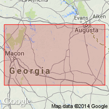
- Areal extent
- AAPG geologic province:
-
- South Georgia sedimentary province
- Atlantic Coast basin
Summary:
Irwinton Sand Member assigned to Dry Branch Formation of Barnwell Group. Unit is thickest member of Dry Branch and constitutes greater proportion of Formation updip. Thins and is restricted to upper part of Dry Branch downdip. Represents most restricted marginal marine environment of Dry Branch. Unit is recognized in Aiken Co., SC, where it is basal member of formation. Irwinton should replace Roberta sand (of Connell, 1958), as it is identical in lithology and stratigraphic position. Extends from Crawford Co., GA, to Lexington and Orangeburg Cos, SC. Interfingers with Twiggs Clay and Griffins Landing Members, both of Dry Branch Formation. Age is late Eocene.
Source: GNU records (USGS DDS-6; Reston GNULEX).
For more information, please contact Nancy Stamm, Geologic Names Committee Secretary.
Asterisk (*) indicates published by U.S. Geological Survey authors.
"No current usage" (†) implies that a name has been abandoned or has fallen into disuse. Former usage and, if known, replacement name given in parentheses ( ).
Slash (/) indicates name conflicts with nomenclatural guidelines (CSN, 1933; ACSN, 1961, 1970; NACSN, 1983, 2005, 2021). May be explained within brackets ([ ]).