The National Geologic Map Database is migrating to a new infrastructure. We apologize for any service disruptions during this process.
|
|---|


- Usage in publication:
-
- Ironton Hollow rhyolite
- Modifications:
-
- First used
- Dominant lithology:
-
- Rhyolite
- AAPG geologic province:
-
- Midcontinent region
Summary:
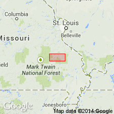
First published use in St. Francois Mountains, southeast MO, Midcontinent region. [Not clear if authors intended stratigraphic units within study area to be formal or informal.] No type locality designated; derivation of name not discussed. Mapped undivided with Iron Mountain Lake felsite (first used), Tribby breccia (first used), and Wolf Mountain ignimbrite (brief mention) in area between Iron Mountain, St. Francois Co, and Ironton, Iron Co. Consists of series of rhyolitic lava flows, locally autobrecciated; also includes breccia which may be a lahar. Generally described as dark-maroon porphyritic rock consisting of quartz and plagioclase phenocrysts in matrix of fine granular quartz and feldspar. Lithophysae abundant locally. Thickness is greater than 130 m. Younger than Wolf Mountain; older than "Unit 690" of Berry (unpub. MS thesis). Table of stratigraphic units; geologic map. Most volcanic rocks of St. Francois Mountains are 1485 m.y. old (Proterozoic).
[Authors' intentions are unclear as to which, if any, of the geologic units discussed should have formal status.]
Source: GNU records (USGS DDS-6; Denver GNULEX).
- Usage in publication:
-
- Ironton Hollow Rhyolite
- Modifications:
-
- Overview
- AAPG geologic province:
-
- Midcontinent region
Summary:
Mapped (fig. 1) in parts of Iron Mountain Lake and Graniteville quads, central St. Francois Mountains, MO, Midcontinent region. Occurs west of regional angular unconformity. (Rocks east and north of unconformity are older than rocks west of it). Consists of a series of locally autobrecciated lava flows with minor intercalated volcaniclastic tuff and lahar. Lavas are crystal-poor and have flow banded fabric. Granite porphyry stock in north central part of study area is interpreted to be shallow subvolcanic equivalent to lavas of Ironton Hollow. Petrologic data. Overlies Tribby Breccia; underlies rhyolitic Unit 690 of Berry (1970, Ph.D. dissert., Univ. of KS). Proterozoic age (1440-1480 Ma).
Source: GNU records (USGS DDS-6; Denver GNULEX).
For more information, please contact Nancy Stamm, Geologic Names Committee Secretary.
Asterisk (*) indicates published by U.S. Geological Survey authors.
"No current usage" (†) implies that a name has been abandoned or has fallen into disuse. Former usage and, if known, replacement name given in parentheses ( ).
Slash (/) indicates name conflicts with nomenclatural guidelines (CSN, 1933; ACSN, 1961, 1970; NACSN, 1983, 2005, 2021). May be explained within brackets ([ ]).