- Usage in publication:
-
- Ironshire Formation*
- Modifications:
-
- Named
- Dominant lithology:
-
- Sand
- AAPG geologic province:
-
- Atlantic Coast basin
Summary:
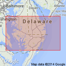
Named the Ironshire Formation for Ironshire, Delmarva Peninsula, Worcester Co., MD. Consists of pale-yellow to white, coarsening upward, cross-bedded, fluviatile-estuarine channel fill and beach sand, and gravelly sand. Thickness is 7.6 meters at type locality and ranges from 7 to 33 meters. Unit unconformably overlies the Beaverdam Sand or Omar Formation against east-facing scarp. The Ironshire is of Pleistocene (Sangamonian) age.
Source: GNU records (USGS DDS-6; Reston GNULEX).
- Usage in publication:
-
- Ironshire Formation
- AAPG geologic province:
-
- Atlantic Coast basin
Ramsey, K.W., 2010, Stratigraphy, correlation, and depositional environments of the middle to late Pleistocene interglacial deposits of southern Delaware: Delaware Geological Survey Report of Investigations, no. 76, 43 p.
Summary:
Pg. 15+. Ironshire Formation of Assawoman Bay Group. [Not synopsized to date. See also Ramsey, K.W., 2010, Geol. map Georgetown quadrangle, Delaware Geol. Survey, Geol. Map Ser., no. 15, scale 1:24,000, and references therein.]
Source: NA
For more information, please contact Nancy Stamm, Geologic Names Committee Secretary.
Asterisk (*) indicates published by U.S. Geological Survey authors.
"No current usage" (†) implies that a name has been abandoned or has fallen into disuse. Former usage and, if known, replacement name given in parentheses ( ).
Slash (/) indicates name conflicts with nomenclatural guidelines (CSN, 1933; ACSN, 1961, 1970; NACSN, 1983, 2005, 2021). May be explained within brackets ([ ]).

