

- Usage in publication:
-
- Irons Fork Mountain Formation
- Modifications:
-
- Named
- Reference
- Dominant lithology:
-
- Sandstone
- Shale
- AAPG geologic province:
-
- Ouachita folded belt
- Arkoma basin
Summary:
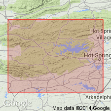
Named as lower formation of Jackfork Group in western AR for Irons Fork Mountain along U.S. Forest Service road 216, secs 21, 22, 23, 24, 27, 28, T1S, R28W, Polk Co, AR in Ouachita tectonic belt province. These exposures are the type locality (also called type section). Conformably overlies Chickasaw Creek Formation, upper formation of Stanley Group. Basal contact placed at base of sandstone (Irons Fork Mountain) above siliceous shale (Chickasaw Creek). Reference locality [not described] designated 50 mi east in Forked Mountain area, Little Cedar Creek anticline, NW1/4 sec 4, T2N, R19W to SW1/4 sec 33, T3N, R19W, Saline Co (Ouachita tectonic belt province) into adjoining Perry Co (Arkoma basin). Ranges from 2,000 to 2,545 (type) ft thick. Consists of moderately well to well sorted, ridge-forming, quartz sandstone and dark- to medium-gray shale with some pyrite and carbonaceous plant remains. The lower part is mostly ridge-forming sandstone interbedded with shale; the upper part is mostly soft contorted valley-forming shale. Underlies Brushy Knob Formation (new), upper formation of Jackfork Group. Upper contact is soft shale (Iron Fork Mountain) with massive ridge-forming sandstone (Brushy Knob). Mississippian age. Correlation chart; measured sections. A turbidite and pelagic deposit.
Source: GNU records (USGS DDS-6; Denver GNULEX).
- Usage in publication:
-
- Irons Fork Mountain Formation
- Modifications:
-
- Age modified
- AAPG geologic province:
-
- Ouachita folded belt
- Arkoma basin
Summary:
Age of Jackfork Group, and hence its Irons Fork Mountain and Brushy Knob Formations, is based on presence of Pitkin fossils (Mississippian) in reworked limestone boulders in underlying Chickasaw Creek Formation, upper formation of Stanley Group. Jackfork and its formations are thought to be of Morrowan or Early Pennsylvanian age, rather than Mississippian age, in western AR in the Ouachita tectonic belt province and in the Arkoma basin. Gray sandstone--proximal and distal-turbidite facies--makes up 35-40 percent of the formation. Black to gray shale, mudstone, and siltstone make up the rest.
Source: GNU records (USGS DDS-6; Denver GNULEX).
For more information, please contact Nancy Stamm, Geologic Names Committee Secretary.
Asterisk (*) indicates published by U.S. Geological Survey authors.
"No current usage" (†) implies that a name has been abandoned or has fallen into disuse. Former usage and, if known, replacement name given in parentheses ( ).
Slash (/) indicates name conflicts with nomenclatural guidelines (CSN, 1933; ACSN, 1961, 1970; NACSN, 1983, 2005, 2021). May be explained within brackets ([ ]).