The National Geologic Map Database is migrating to a new infrastructure. We apologize for any service disruptions during this process.
|
|---|


- Usage in publication:
-
- Iron Springs formation
- Modifications:
-
- First used
- Dominant lithology:
-
- Conglomerate
- Sandstone
- Limestone
- Shale
- AAPG geologic province:
-
- Great Basin province
Summary:
First published use as a name for 3,500 to 5,000 ft thick conglomerate, limestone, sandstone, and shale that disconformably overlies the "Entrada" formation and unconformably underlies Claron formation. Lower part is gray to brown and divisible into (ascending): member A, a conglomerate of pebbles and cobbles, chiefly quartzite, some limestone in a gray quartzitic matrix; member B, the gradationally overlying variegated fresh-water limestone; member C, the gradationally overlying coarse cross-bedded limy channel sand[stone] and conglomerate and interlensed overbank siltstone, shale, and rarely fresh water limestone; member D, same lithology as member C, except that it has an increased number of conglomerate lenses; members E and G are variegated limestone separated by the coarse brown limy sandstone with some shale and grit of member F. The entire lower sequence is gradational; each member varies in thickness; total thickness of lower part is 1,000 to 1,500 ft; is overlain in some parts of Iron Springs district by upper part, a 2,500 to 3,500 ft of gray to brown coarse limy cross-bedded sandstone, locally conglomeratic, and interlensed shale. Geologic maps. Cross sections. Of Late Cretaceous age. Formerly called Pinto sandstone.
Source: GNU records (USGS DDS-6; Denver GNULEX).
- Usage in publication:
-
- Iron Springs formation*
- Modifications:
-
- Overview
- AAPG geologic province:
-
- Great Basin province
Summary:
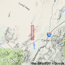
Name applied to rocks unconformably above the Jurassic Entrada sandstone and beneath the Eocene? Claron formation. These rocks, as well as the underlying Entrada, were assigned to the Pinto sandstone by Leith and Harder (1908). Name Pinto abandoned. Iron Springs consists of lenticular beds of sandstone, shale, conglomerate, and fresh-water limestone, all irregular in distribution. Locally basal part divided on basis of lithology. Has a maximum thickness of 3,000 ft. Mapped (geologic map) in northeast part of quad south of the Three Peaks intrusion and northeast of Granite Mountain, and in southwest part of quad near Desert Mound arch, Iron Co, UT in the Great Basin province. Assigned a Late? Cretaceous age.
Source: GNU records (USGS DDS-6; Denver GNULEX).
- Usage in publication:
-
- Iron Springs Formation*
- Modifications:
-
- Mapped 1:24k
- Dominant lithology:
-
- Sandstone
- Shale
- Conglomerate
- Limestone
- Coal
- AAPG geologic province:
-
- Great Basin province
Summary:
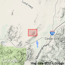
Is Upper? Cretaceous formation mapped in vicinity of the Granite Mountain and The Three Peaks plutons along Iron Springs Creek in northwest part of quadrangle, Iron Co, UT (Great Basin province). Overlies Marshall Creek Breccia (Upper Cretaceous?). Unconformably overlain by Claron Formation (Eocene and Oligocene). Is described as light-brown thin- to thick-bedded continental resistant cross-bedded medium- to coarse-grained sandstone and lesser amounts of poorly resistant interbedded shale containing resistant conglomerate, limestone, and minor coal. Probably at least 3,000 ft (900 m) thick in this and adjoining quadrangles. In the type locality near the plutons Mackin (1947) defined and divided the formation into a thick upper unit and four thin lower rock units (members D, C, B, A) which total 400-500 ft (120-150 m) in thickness. To fit the scale of the present map, members D and C are combined to form a middle member, and members B and A to form a lower member. Upper member--includes the bulk of the formation, the lithologic characteristics of which are described above, at least 2,500 ft (760 m) thick. Middle member--members D and C of Mackin (1947); member C of Mackin (1954); consists of two parts: resistant light-gray to light-brown pebble- to cobble-conglomerate bed, the clasts of which are largely limestone, 10-50 ft (3-15 m) thick (member D of Mackin, 1947), underlain by thin- to medium-bedded resistant light-gray to light-brown coarse-grained sandstone and interbedded shale, limestone, and conglomerate, 150-350 ft (45-110 m) thick (member C of Mackin, 1947). Lower member--consists of two parts: poorly resistant thin- to medium-bedded variegated fresh-water limestone and siltstone, and lesser amounts of shale, sandstone, and conglomerate, 150-250 ft (45-75 m) thick (member B of Mackin, 1947, 1954), underlain by a basal resistant light-gray to light-brown pebble- to cobble-conglomerate, the clasts of which are mostly quartzite, and lesser limestone, 0-50 ft (0-15 m) thick (member A of Mackin, 1947, 1954).
Source: GNU records (USGS DDS-6; Denver GNULEX).
- Usage in publication:
-
- Iron Springs Formation
- Modifications:
-
- Age modified
- AAPG geologic province:
-
- Great Basin province
Summary:
Pollen from black shale layer in Iron Springs Formation at a roadcut just south of Gunlock was analyzed by R. A. Christopher. Overall palynomorph assemblage, rather than index forms, suggests Cenomanian through Turonian age. Palynology is in reasonably close agreement with fission-track age of 80.0 +/-10 m.y. made by B. J. Kowallis on zircons from 20-ft-thick bentonitic bed directly underlying Iron Springs. Contact between bentonitic bed and Iron Springs is not clearly exposed, but may be conformable.
Source: GNU records (USGS DDS-6; Denver GNULEX).
- Usage in publication:
-
- Iron Springs Formation*
- Modifications:
-
- Mapped 1:24k
- Dominant lithology:
-
- Sandstone
- Shale
- Conglomerate
- Limestone
- AAPG geologic province:
-
- Great Basin province
Summary:
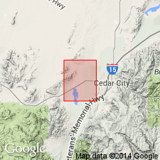
Is Upper? Cretaceous formation mapped east of Antelope Range fault zone in southern Antelope Range in southern part of quadrangle, Iron Co, UT (Great Basin province). Is oldest unit mapped in quadrangle. Unconformably overlain by Claron Formation (Oligocene and Eocene). Map unit described as soft to moderately resistant, light-brown, light-yellow, and light-gray, thin- to thick-bedded, cross-bedded, medium- to coarse-grained lenticular continental sandstone and soft interbedded shale, and subordinate, moderately resistant conglomerate, limestone, and carbonaceous shale. Most clasts in conglomerate are light-gray quartzite. Exposed as incomplete sections, at least 200 m thick; about 1100 m thick in Silver Peak quadrangle (Shubat and Siders, 1988).
Source: GNU records (USGS DDS-6; Denver GNULEX).
- Usage in publication:
-
- Iron Springs Formation
- Modifications:
-
- Age modified
- AAPG geologic province:
-
- Great Basin province
Summary:
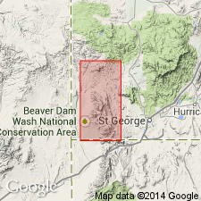
Age is poorly constrained. In southern Beaver Dam Mountains, Washington Co, southwest UT, Great Basin province, palynomorph data from lower part indicate Cenomanian to Santonian age (Hintze, 1986). [R. A. Christopher (1984, written commun.) reported in Hintze (1986, p.18) a Cenomanian through Turonian, not Santonian, age "Based on the overall palynomorph assemblage rather than on the presence of index forms..."] However, fission-track data from bentonitic unit below Claron suggest an early Campanian age (Hintze, 1986). [Fission-track date determined by Kowallis (1984, personal commun.) reported in Hintze (1986, p.16-17) was 80 +/-10 m.y. which could make sample as old as Turonian and as young as Maastrichtian.] Early Campanian palynomorphs have been identified on the Markagunt Plateau (J.G. Eaton, 1992, personal commun.) from a sandstone-mudstone unit overlying Iron Springs Formation. Thus, Iron Springs ranges in age from Cenomanian to Santonian but could be as young as early Campanian and is coeval with Dakota, Tropic, and Straight Cliffs Formations in Kaiparowits Plateau region to east in central Garfield Co, UT, Paradox basin. Correlation chart. Is oldest unit discussed; unconformably underlies informal "Grand Castle formation" a unit removed from upper part of Canaan Peak Formation (revised) in Kaiparowits Plateau.
Source: GNU records (USGS DDS-6; Denver GNULEX).
For more information, please contact Nancy Stamm, Geologic Names Committee Secretary.
Asterisk (*) indicates published by U.S. Geological Survey authors.
"No current usage" (†) implies that a name has been abandoned or has fallen into disuse. Former usage and, if known, replacement name given in parentheses ( ).
Slash (/) indicates name conflicts with nomenclatural guidelines (CSN, 1933; ACSN, 1961, 1970; NACSN, 1983, 2005, 2021). May be explained within brackets ([ ]).