- Usage in publication:
-
- Intracoastal Formation
- Modifications:
-
- Named
- Dominant lithology:
-
- Limestone
- AAPG geologic province:
-
- Mid-Gulf Coast basin
Summary:
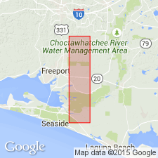
Intracoastal Formation was first introduced in a 1976 abstract by P.F. Huddlestun as Intracoastal Limestone of Coastal Group. Unit is here formally named and described as a gray, olive-green, argillaceous, calcarenitic, sandy limestone. Includes strata referred to as St. Joe Limestone by Huddlestun (1976). It is poorly consolidated, microfossiliferous, and subsurface, measuring 49 m in the type core. Ranges from <1 to 73 m thick. Missing biostratigraphic zones indicate late Miocene-early Pliocene hiatus. Unconformably overlies Bruce Creek Limestone; underlies or interfingers with Jackson Bluff Formation or unconformably underlies Pliocene to Holocene sands.
Source: GNU records (USGS DDS-6; Reston GNULEX).

- Usage in publication:
-
- Intracoastal Formation
- Modifications:
-
- Overview
- Revised
- AAPG geologic province:
-
- Mid-Gulf Coast basin
Summary:
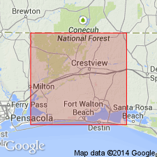
Maximum thickness of Intracoastal Formation stated as 440 ft. Unit is wedge-shaped; thickens offshore and thins inland. Includes the Four-Mile Village Member, here named. Member is a wedge-shaped tongue of phosphatic sand, 58 ft thick. Underlies Pliocene to Holocene sands and overlies Bruce Creek Limestone (middle Miocene). Interfingers Pensacola Clay and Alum Bluff sediments. Age given as middle Miocene to Pliocene.
Source: GNU records (USGS DDS-6; Reston GNULEX).

- Usage in publication:
-
- Intracoastal Formation
- Modifications:
-
- Overview
- Areal extent
- AAPG geologic province:
-
- South Georgia sedimentary province
Summary:
The Intracoastal is a wedge-shaped unit dipping southwestward and westward, and extending from eastern Franklin Co and western Wakulla Co. to the Okaloosa-Santa Rosa Co. line. It reaches a maximum thickness of 300 ft in southwestern Gulf Co. Unit is a light gray to yellowish-gray, glauconitic, phosphatic, and sometimes argillaceous, highly fossiliferous marine limestone. Though age is middle Miocene to late Pliocene, a hiatus probably occurred in the late Miocene. Overlies Bruce Creek Formation and unconformably underlies "Chipola-like" sediments.
Source: GNU records (USGS DDS-6; Reston GNULEX).
For more information, please contact Nancy Stamm, Geologic Names Committee Secretary.
Asterisk (*) indicates published by U.S. Geological Survey authors.
"No current usage" (†) implies that a name has been abandoned or has fallen into disuse. Former usage and, if known, replacement name given in parentheses ( ).
Slash (/) indicates name conflicts with nomenclatural guidelines (CSN, 1933; ACSN, 1961, 1970; NACSN, 1983, 2005, 2021). May be explained within brackets ([ ]).

