The National Geologic Map Database is migrating to a new infrastructure. We apologize for any service disruptions during this process.
|
|---|


- Usage in publication:
-
- Laycock Graywacke*
- Modifications:
-
- Overview
- AAPG geologic province:
-
- Blue Mountains province
Summary:
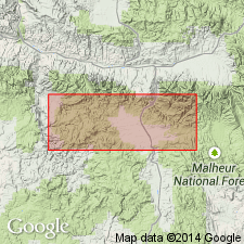
Pg. A26, A29 (fig. 4). Laycock Graywacke of Aldrich Mountains Group (Brown and Thayer, 1966, USGS I-447). Underlies most of upper drainage basin of Laycock Creek, in southeast quarter of Mount Vernon quadrangle. Consists mainly of dark-colored and well-bedded graded graywacke, mudstone, and shale; includes submarine slide lenses of massive graywacke having a heterogeneous mixture of randomly distributed coarse lithic clasts. Greatest known thickness is about 11,000 feet, in section extending from Laycock Creek to Fall Mountain. Lower part consists of coarse- to medium-grained graywacke and black shale. Upper part is more shaly and tuffaceous and grades westward into tuff and feldspathic graywacke of the Ingle Tuff Tongue (Brown and Thayer, 1966, USGS GQ-548), a waterlaid dark-gray, feldspar-rich, andesitic tuff and tuffaceous graywacke, 0 to 3,000 feet thick. Base of formation is faulted off in Laycock Creek; to the west, grades downward lithologically into Fields Creek Formation with increasingly stronger folding. Conformably underlies Murderers Creek Graywacke, which is also no older than late Late Triassic. Age is considered Late Triassic(?).
Source: Publication.

- Usage in publication:
-
- Ingle Tuff Tongue*
- Modifications:
-
- Named
- Dominant lithology:
-
- Tuff
- Graywacke
- AAPG geologic province:
-
- Blue Mountains province
Summary:
Named for outcrops in headwaters of Ingle Creek and on east slopes of Ingle Mountain, Mount Vernon 15' quad, Grant Co, OR. [no type designated] Composed of water-laid dark-gray feldspar-rich andesitic tuff and tuffaceous graywacke. Thickness is 3,000 ft on Ingle Mountain. Tuff grades into and interfingers with shale and graywacke in vicinity of Laycock Creek on east and near Riley Creek on west. Overlies Field Creek Formation. Underlies Murderers Creek Graywacke. Assigned Late Triassic(?) age.
Source: GNU records (USGS DDS-6; Menlo GNULEX).
- Usage in publication:
-
- Ingle Tuff Tongue*
- Modifications:
-
- Age modified
- AAPG geologic province:
-
- Blue Mountains province
Summary:
Laycock Graywacke of Aldrich Mountains Group is mapped in eastern Aldrich Mountains. [Ingle Tuff Tongue is not shown separately.] Age of Lay cock Graywacke [and thus included Ingle Tuff Tongue] is Late Triassic.
Source: GNU records (USGS DDS-6; Menlo GNULEX).
For more information, please contact Nancy Stamm, Geologic Names Committee Secretary.
Asterisk (*) indicates published by U.S. Geological Survey authors.
"No current usage" (†) implies that a name has been abandoned or has fallen into disuse. Former usage and, if known, replacement name given in parentheses ( ).
Slash (/) indicates name conflicts with nomenclatural guidelines (CSN, 1933; ACSN, 1961, 1970; NACSN, 1983, 2005, 2021). May be explained within brackets ([ ]).