

- Usage in publication:
-
- Indio formation*
- Modifications:
-
- Original reference
- Dominant lithology:
-
- Sand
- Shale
- AAPG geologic province:
-
- Gulf Coast basin
Summary:
Indio formation of Wilcox group. The strata overlying the maine Midway formation and underlying Carrizo sandstone in Gulf Coastal Plain of Texas adjacent to Rio Grande. Consists chiefly of thin-bedded and laminated argillaceous sand and arenaceous shale, but includes some layers of massive clay and lenses and layers of sandstone. The clay and shale are greenish or bluish gray and light chocolate brown, and most of them are gypsiferous. The sandstone is gray, yellow, green, and brown, is not notably cross-bedded, and is various textures. Includes some beds of lignite and many calcareous and arenaceous concretions. Thickness 648 to 700+/- feet. Is basal formation of Wilcox group in southern Texas. Age is early Eocene.
[GNC remark (ca. 1936, US geologic names lexicon, USGS Bull. 896, p. 1012): The overlying Carrizo sand and Bigford formation were formerly considered to be of Wilcox age, but are now assigned to Claiborne group by most geologist. This leaves the Indio the only representative of Wilcox group in Texas.]
Source: US geologic names lexicon (USGS Bull. 896, p. 1012).

- Usage in publication:
-
- Indio Formation
- Modifications:
-
- Mapped 1:250k
- Dominant lithology:
-
- Sandstone
- Shale
- Lignite
- AAPG geologic province:
-
- Gulf Coast basin
Summary:
Indio Formation. Sandstone, shale, and lignite; sandstone, fine-grained, thin-bedded, varicolored in grays, yellows, greens, and browns; shale, sandy, carbonaceous, greenish gray to medium gray and chocolate brown; numerous calcareous, arenaceous, and ferruginous concretions, more abundant near Carrizo contact. Thickness about 450 to 900 feet, thickens southward. Lies above Kincaid Formation and below Carrizo Sand. Age is Eocene.
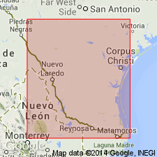
[Mapped in Maverick, Zavala, Dimmit, and Webb Cos., southwestern TX.]
Source: Publication.

- Usage in publication:
-
- Indio Formation
- Modifications:
-
- Mapped 1:250k
- Dominant lithology:
-
- Sandstone
- Shale
- Lignite
- AAPG geologic province:
-
- Gulf Coast basin
Summary:
Is Eocene formation mapped in northeastern Maverick and northwestern Zavala Cos, TX (Gulf Coast basin). Overlies Upper Cretaceous Escondido Formation. Overlain by Quaternary terrace or alluvial deposits. Map unit described as sandstone, shale, and lignite; sandstone--fine-grained, thin-bedded, varicolored in grays, yellows, greens, and browns; shale--sandy, carbonaceous, greenish-gray to medium-gray and chocolate-brown; numerous calcareous, arenaceous, and ferruginous concretions; thickness about 250 ft, thickens southward.
Source: GNU records (USGS DDS-6; Denver GNULEX).

- Usage in publication:
-
- Indio Formation
- Modifications:
-
- Mapped 1:250k
- Dominant lithology:
-
- Sandstone
- Shale
- Siltstone
- Lignite
- AAPG geologic province:
-
- Gulf Coast basin
- Ouachita folded belt
Summary:
Pamphlet [p. 4]. Indio Formation of Wilcox Group. Sandstone, shale, siltstone, and lignite; sandstone, fine-grained, thin-bedded to laminar, varicolored in grays, yellows, greens, and browns; shale carbonaceous, laminar, greenish gray to medium-gray and chocolate brown; siltstone, thin-bedded to laminar; includes some beds of lignite and many calcareous and arenaceous concretions; thickness about 440 feet. Underlies Carrizo Sand and younger sediments; overlies Kincaid Formation of Midway Group. Age is Eocene.
[Notable exposures west of Frio River in southwestern part of map sheet, in Uvalde and Zavala Cos., southern TX.]
Source: Publication.
For more information, please contact Nancy Stamm, Geologic Names Committee Secretary.
Asterisk (*) indicates published by U.S. Geological Survey authors.
"No current usage" (†) implies that a name has been abandoned or has fallen into disuse. Former usage and, if known, replacement name given in parentheses ( ).
Slash (/) indicates name conflicts with nomenclatural guidelines (CSN, 1933; ACSN, 1961, 1970; NACSN, 1983, 2005, 2021). May be explained within brackets ([ ]).