The National Geologic Map Database is migrating to a new infrastructure. We apologize for any service disruptions during this process.
|
|---|


- Usage in publication:
-
- Indianola group
- Modifications:
-
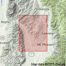
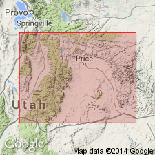
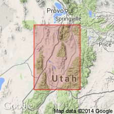
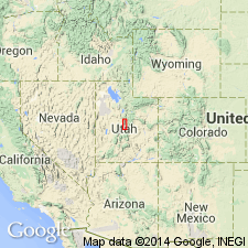
- Areal extent
- Dominant lithology:
-
- Conglomerate
- Sandstone
- Shale
- Limestone
- AAPG geologic province:
-
- Wasatch uplift
Summary:
Pg. 378. Indianola group. Series of conglomerates, sandstones, shales, and minor limestones. Thickness 9,350 to 14,680 feet. In Gunnison Plateau, overlies Arapien shale (new); underlies Price River formation. Name credited to E.M. Spieker. [Age is Late Cretaceous.]
Source: US geologic names lexicon (USGS Bull. 1200, p. 1866).
- Usage in publication:
-
- Indianola group*
- Modifications:
-
- Principal reference
- Dominant lithology:
-
- Conglomerate
- Sandstone
- Shale
- Limestone
- AAPG geologic province:
-
- Wasatch uplift
Summary:
Pg. 122, 126-130. Indianola group. A heterogeneous assemblage of conglomerate, sandstone, shale, and limestone of both marine and continental origin. In Thistle, Sixmile, and Salina Canyon areas, the unit, truncated by Price River and younger formations, is subdivided into four formations (ascending): Sanpete, Allen Valley shale, Funk Valley, and Sixmile Canyon (all new); in other areas undifferentiated. [Thickness about 7,200 feet.] Overlies the Morrison(?) formation. Fossils; carries a Colorado fauna. Age is Late Cretaceous. Type area designated.
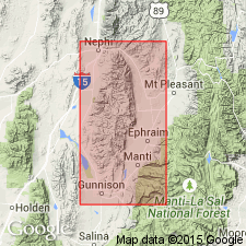
Type area: Indianola district, [Manti sheet (scale 1:250,000), Sanpete and Utah Cos.], Wasatch Plateau, central UT.
Source: Publication; US geologic names lexicon (USGS Bull. 1200, p. 1866).
- Usage in publication:
-
- Indianola group
- Modifications:
-
- Areal extent
- AAPG geologic province:
-
- Wasatch uplift
Summary:
Is a thick mass of coarse rubble, all of Colorado age, derived from nearby mountains and dumped into a foredeep. Lithology changes rapidly from coarse conglomerate to shale, silt, and sandstone in central UT. Can be divided into four formations (Sanpete, Allen Valley, Funk Valley, Sixmile Canyon) in western marginal belt of the Wasatch Plateau at Thistle, Indianola, Sixmile, and Salina districts. West of the Wasatch Plateau, it attains 8,000 to nearly 15,000 ft thick, and cannot be separated into formations. West of the Plateau, the group is composed of conglomerate and sandstone with interbeds of freshwater limestone and littoral marine sandstone. The best exposures of the undivided unit are in the northern part of Gunnison Plateau, the Cedar Hills, and in canyon of Chicken Creek east of Levan, on the Wasatch uplift.
Source: GNU records (USGS DDS-6; Denver GNULEX).
- Usage in publication:
-
- Indianola group*
- Modifications:
-
- Areal extent
- AAPG geologic province:
-
- Wasatch uplift
Summary:
Pg. 622, 624-627. In Cedar Hills, central Utah, undifferentiated Indianola is about 14,680 feet thick. Unconformably overlain by fluviatile and lacustrine deposits ranging from Montana to Eocene in age (Price River, North Horn, Flagstaff, Colton, and Green River formations). [Age is Late Cretaceous.]
Source: US geologic names lexicon (USGS Bull. 1200, p. 1866).

- Usage in publication:
-
- Indianola Group*
- Modifications:
-
- Age modified
- AAPG geologic province:
-
- Wasatch uplift
Summary:
Divided into: Sanpete Formation (late Cenomanian and early Turonian palynomorphs), Allen Valley Shale (middle Turonian palynomorphs), Funk Valley Formation (late Turonian and early Santonian ostracods and foraminifers), and Sixmile Canyon Formation (late Santonian and early Campanian) on the Wasatch uplift.
Source: GNU records (USGS DDS-6; Denver GNULEX).
- Usage in publication:
-
- Indianola Group
- Modifications:
-
- Areal extent
- AAPG geologic province:
-
- Great Basin province
- Wasatch uplift
Summary:
Some rocks formerly assigned by various authors to the Morrison? Formation, to the Morrison? Formation and Indianola Group, or to Cedar Mountain and Indianola Group, are named Pigeon Creek Formation. The new name will be used on the Wasatch and Gunnison Plateaus of central UT, in eastern Juab Co (Great Basin province), and from Thistle on north to Salina on south (Wasatch uplift). Pigeon Creek unconformably overlies Jurassic Twist Gulch Formation, unconformably underlies Indianola Group, and is of Neocomian, Aptian and Albian ages. Stratigraphic figures.
Source: GNU records (USGS DDS-6; Denver GNULEX).
- Usage in publication:
-
- Indianola Group
- Modifications:
-
- Revised
- AAPG geologic province:
-
- Wasatch uplift
Summary:
Rocks along west side of Gunnison Reservoir and extending southwestward for 5 mi to U. S. Highway 89, Sanpete Co, UT, Wasatch uplift, previously called Morrison? by earlier workers are here called (ascending) Cedar Mountain Formation and a new unnamed basal unit of Indianola. (Indianola now consists of (ascending): unnamed basal unit and Sanpete, Allen Valley, Funk Valley, and Sixmile Canyon Formations. Cedar Mountain and unnamed basal unit are correlative to Pigeon Creek Formation (new) of Schwans (same volume, p. 531-556). Interval not called Pigeon Creek here as authors feel additional study is needed. Unnamed basal unit contains palynomorphs no older than Cenomanian, limited mollusks and plants no older than early Cenomanian or late Albian, and leaf prints of late Albian to early Cenomanian age. Outcrop shown on fig 1. Stratigraphic column. Tables 1 and 2 are condensed stratigraphic sections at, and south of, Radio Tower Valley; thicknesses are 288 m and 167 m, respectively. Described on column as red-orange mudstone and sandstone (50%) and red-brown conglomerate (50%) with sandstone lenses; 16-27 m-thick boulder conglomerate at top of unit. Underlies Sanpete Formation of Indianola. [Assigning unnamed basal unit is a major revision to Indianola as these rocks are not present at type Indianola. Either a new name should be used in place of Indianola or basal unit should not be included with Indianola.]
Source: GNU records (USGS DDS-6; Denver GNULEX).
- Usage in publication:
-
- Indianola Group*
- Modifications:
-
- Revised
- AAPG geologic province:
-
- Wasatch uplift
Summary:
Indianola Group. In central Utah, revised to include Lower Cretaceous San Pitch Formation (new) at its base. Overlies Cedar Mountain Formation. [See also entry under San Pitch.]
Source: Publication.
For more information, please contact Nancy Stamm, Geologic Names Committee Secretary.
Asterisk (*) indicates published by U.S. Geological Survey authors.
"No current usage" (†) implies that a name has been abandoned or has fallen into disuse. Former usage and, if known, replacement name given in parentheses ( ).
Slash (/) indicates name conflicts with nomenclatural guidelines (CSN, 1933; ACSN, 1961, 1970; NACSN, 1983, 2005, 2021). May be explained within brackets ([ ]).