The National Geologic Map Database is migrating to a new infrastructure. We apologize for any service disruptions during this process.
|
|---|


- Usage in publication:
-
- Indian Trail Formation*
- Modifications:
-
- Named
- Dominant lithology:
-
- Tuff
- AAPG geologic province:
-
- Great Basin province
Summary:
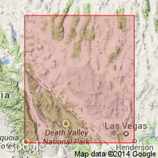
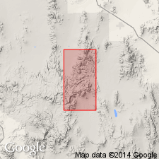
Name applied to some rocks formerly assigned to the lower part of the Oak Spring Formation. Named as the basal formation of the Oak Spring Group (rank raised) for exposures (the type locality) in Indian Trail Wash on southeast flank of Oak Spring Butte, Nevada Test Site, Nye Co, NV in the Great Basin province. Divided into a lower member, Tub Spring Member (middle), and Grouse Canyon Member (top). Tub Spring and Grouse Canyon were formerly members of the Oak Spring Formation. Lower member consists predominantly of rhyolitic ash-flow tuffs, some of which are welded, ash-fall tuff and reworked tuff. Source of tuffs was probably a nearby vent. Tub Spring and Grouse Canyon wedge out southward from Oak Spring Butte area; they thicken and become more densely welded northward. Tub Spring and Grouse Canyon are multiple-flow simple cooling units. They are probably related to a volcanic center north of the Test Site. Cross section. Overlain by Piapi Canyon Formation (new), upper formation of Oak Spring Group. Underlain by Paleozoic rocks. Of late Miocene or early Pliocene age.
Source: GNU records (USGS DDS-6; Denver GNULEX).
- Usage in publication:
-
- Indian Trail Formation*
- Modifications:
-
- Revised
- Age modified
- AAPG geologic province:
-
- Great Basin province
Summary:
Use of Oak Spring Group for Tertiary rocks in Nevada Test Site abandoned. [Indian Trail Formation was formerly part of Oak Spring Group.] Base of Indian Trail Formation in northern part of Test Site is about 16 Ma. Using Kulp's (1961) geologic time scale, age is Miocene and Pliocene(?).
Source: GNU records (USGS DDS-6; Menlo GNULEX).
- Usage in publication:
-
- Indian Trail Formation
- Modifications:
-
- Areal extent
- AAPG geologic province:
-
- Great Basin province
Summary:
Use of name for age-equivalent rocks north of Nevada Test Site implies lithologic and genetic relationships that do not exist. Areally restricted to the east part of the Test Site, east of long 116 deg 15 min, Nye Co, NV in the Great Basin province. Is no longer part of Oak Spring Group, a name abandoned in this report. Divided into local informal units, and the Tub Spring Member in the lower part and the Grouse Canyon Member at the top. In the western part of the Test Site, its partial equivalent is the Belted Range Tuff (new). The local informal units beneath the Tub Spring Member, newly assigned to the Belted Range as its basal member in the west part of the Test Site, are not assigned to a formation. The top of the Belted Range is placed at the top of the Grouse Canyon Member, newly assigned to the Belted Range. Local informal units that occur between and west of the west limits of Tub Spring and Grouse Canyon are also placed in the Belted Range. Paintbrush Tuff overlies Indian Trail in the east part of the Test Site. Stratigraphic nomenclature chart. Distribution map of Tub Spring and Grouse Canyon. Age of Indian Trail is Miocene and Pliocene? rather than Miocene or Pliocene as thought earlier. Base of the Indian Trail is about 16 m.y. old. The age of the top is unknown but it is older than 13.5 m.y.
Source: GNU records (USGS DDS-6; Denver GNULEX).
- Usage in publication:
-
- Indian Trail Formation*
- Modifications:
-
- Age modified
- Geochronologic dating
- AAPG geologic province:
-
- Great Basin province
Summary:
Age is Miocene based on K-Ar ages of approximately 16.1 to 13.6 Ma.
Source: GNU records (USGS DDS-6; Menlo GNULEX).
- Usage in publication:
-
- Indian Trail Formation*
- Modifications:
-
- Areal extent
- AAPG geologic province:
-
- Great Basin province
Summary:
Indian Trail Formation restricted from Wheelbarrow Peak-Rainier Mesa area. Belted Range Tuff is extended into area; it contains Tub Spring and Grouse Canyon Members formerly assigned to Indian Trail Formation here.
Source: GNU records (USGS DDS-6; Menlo GNULEX).
- Usage in publication:
-
- Indian Trail Formation*†
- Modifications:
-
- Abandoned
Summary:
Abandoned. Its members (ascending)--lower member, Tub Spring, and Grouse Canyon--have been removed and the Tub Spring and Grouse Canyon reassigned to the Belted Range Tuff. Name was restricted to the eastern part of the Test Site but mapping by several authors has shown that as many as seven ash-flow tuffs can be separated out from the lower member and traced to other parts of the Test Site. Three of the tuffs have been named and are widespread. These are the Crater Flat Tuff, Redrock Valley Tuff, and Fraction Tuff. The other ash-flow tuffs are designated tuff of Whiterock Spring, tuff of White Blotch Springs, Shingle Pass Tuff, Monotony Tuff. Geologic maps showing distribution of Crater Flat, Redrock Valley, and Fraction Tuffs.
Source: GNU records (USGS DDS-6; Denver GNULEX).
For more information, please contact Nancy Stamm, Geologic Names Committee Secretary.
Asterisk (*) indicates published by U.S. Geological Survey authors.
"No current usage" (†) implies that a name has been abandoned or has fallen into disuse. Former usage and, if known, replacement name given in parentheses ( ).
Slash (/) indicates name conflicts with nomenclatural guidelines (CSN, 1933; ACSN, 1961, 1970; NACSN, 1983, 2005, 2021). May be explained within brackets ([ ]).