The National Geologic Map Database is migrating to a new infrastructure. We apologize for any service disruptions during this process.
|
|---|


- Usage in publication:
-
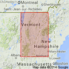
- Indian River slate*
- Modifications:
-
- Named
- Dominant lithology:
-
- Slate
- Quartzite
- AAPG geologic province:
-
- New England province
Summary:
Named the Indian River slate in eastern NY and southwestern VT for Indian River, Washington Co., NY. Consists of bright red slate with, locally, a few thin seams or layers of fine green quartzite. Red color due to iron oxide. Formation furnishes the well-known red slate of NY slate industry. Conformably overlies the Poultney slate and conformably underlies an unnamed black slate. The Indian River is of Middle Ordovician (Chazyan) age.
Source: GNU records (USGS DDS-6; Reston GNULEX).
- Usage in publication:
-
- Indian River member
- Modifications:
-
- Revised
- AAPG geologic province:
-
- New England province
Summary:
Revised the Indian River to the Indian River member of the Normanskill formation in NY.
Source: GNU records (USGS DDS-6; Reston GNULEX).
- Usage in publication:
-
- Indian River Slate*
- Modifications:
-
- Revised
- AAPG geologic province:
-
- New England province
Summary:
Included the Indian River Slate in the Mount Hamilton Group in VT.
Source: GNU records (USGS DDS-6; Reston GNULEX).
- Usage in publication:
-
- Indian River Formation
- Modifications:
-
- Revised
- AAPG geologic province:
-
- New England province
Summary:
Revised the Indian River to the Indian River Formation in southeastern NY.
Source: GNU records (USGS DDS-6; Reston GNULEX).
For more information, please contact Nancy Stamm, Geologic Names Committee Secretary.
Asterisk (*) indicates published by U.S. Geological Survey authors.
"No current usage" (†) implies that a name has been abandoned or has fallen into disuse. Former usage and, if known, replacement name given in parentheses ( ).
Slash (/) indicates name conflicts with nomenclatural guidelines (CSN, 1933; ACSN, 1961, 1970; NACSN, 1983, 2005, 2021). May be explained within brackets ([ ]).