

- Usage in publication:
-
- Indian Fields formation
- Modifications:
-
- Named
- Dominant lithology:
-
- Limestone
- Clay
- AAPG geologic province:
-
- Cincinnati arch
Summary:
Pg. 10, 60; also 1905, Kentucky Geol. Survey Bull., no. 6, p. 145. Indian Fields formation. Introduced for convenience, to include Oldham limestone at top, Plum Creek clay in middle, and "those [pesky] layers of limestone, usually 1 to 2 feet thick, beneath Plum Creek clay which are regarded as belonging above the line of unconformity marked, in east-central Kentucky, by WHITFIELDELLA SUBQUADRATA [brachiopod] and an oolitic iron ore bed." Included in Crab Orchard division, of Niagaran age. Underlies Alger formation and overlies Brassfield limestone. Age is Silurian (Niagaran).
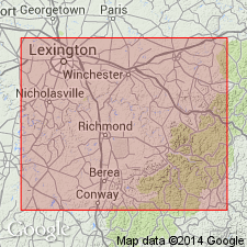
Named from Indian Fields, Clark Co., east-central KY.
Source: US geologic names lexicon (USGS Bull. 896, p. 1009).
- Usage in publication:
-
- Indian Fields Formation
- Modifications:
-
- Not used
- AAPG geologic province:
-
- Cincinnati arch
Summary:
Pg. 31. Name Indian Fields Formation rejected. Has been little used since its introduction (citing Foerste, 1906, p. 18, 60) and like the term Alger, is not a natural nor strictly rock-stratigraphic subdivision of the Crab Orchard Group.
Source: Publication.
For more information, please contact Nancy Stamm, Geologic Names Committee Secretary.
Asterisk (*) indicates published by U.S. Geological Survey authors.
"No current usage" (†) implies that a name has been abandoned or has fallen into disuse. Former usage and, if known, replacement name given in parentheses ( ).
Slash (/) indicates name conflicts with nomenclatural guidelines (CSN, 1933; ACSN, 1961, 1970; NACSN, 1983, 2005, 2021). May be explained within brackets ([ ]).