


- Usage in publication:
-
- Indian Cave sandstone
- Modifications:
-
- Original reference
- Dominant lithology:
-
- Sandstone
Summary:
Pg. 50, 201. Indian Cave sandstone = lower and major part of Towle shale (basal subdivision of Admire group of Moore) and in places cuts out upper beds of underlying Wabaunsee group [restricted]. Present in eastern Kansas. Age is Pennsylvanian.
[This is all of definition.]
Source: US geologic names lexicon (USGS Bull. 896, p. 1009); GNC KS-NE Pennsylvanian Corr. Chart, sheet 2, Oct. 1936.
- Usage in publication:
-
- Indian Cave sandstone
- Modifications:
-
- Principal reference
- AAPG geologic province:
-
- Forest City basin
Summary:
Pg. 37. Indian Cave sandstone (Moore, 1936) in Towle shale formation. Gives areal distribution and derivation of name. Thickness 0 to 50+ feet.
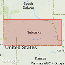
Occurs at Peru, in southeastern Nemaha Co. (at Indian Cave), and near Falls City, Richardson Co., southeastern NE, and at places in eastern KS.
[Indian Cave, approx. Lat. 40 deg. 14 min. 47 sec. N., Long. 95 deg. 31 min. 08 sec. W., Barada 7.5-min quadrangle, Richardson Co., southeastern NE.]
Source: Publication; US geologic names lexicon (USGS Bull. 1200, p. 1862).

- Usage in publication:
-
- Indian Cave sandstone member
- Modifications:
-
- Principal reference
- Revised
- AAPG geologic province:
-
- Forest City basin
Summary:
Pg. 52. Indian Cave sandstone member of Towle shale. Consists of sandstone, siltstone, and locally conglomerate in part; occurs as local channel fillings that grade upward into basal part of the unnamed member of the Towle. Reported maximum thickness about 200 feet. Age is Early Permian (Wolfcampian).
Well exposed in the Indian Cave type locality in Nebraska.
[Indian Cave, approx. Lat. 40 deg. 14 min. 47 sec. N., Long. 95 deg. 31 min. 08 sec. W., Barada 7.5-min quadrangle, Richardson Co., southeastern NE.]
Source: Publication; US geologic names lexicon (USGS Bull. 1200, p. 1862).

- Usage in publication:
-
- Indian Cave channel sandstone bed*
- Modifications:
-
- Revised
Summary:
Pg. 2273, 2274 (fig. 1). Indian Cave channel sandstone bed of Towle shale member of Onaga shale. Rank reduced to bed in Towle shale member of Onaga shale. Age is Permian.
Source: US geologic names lexicon (USGS Bull. 1200, p. 1862).
- Usage in publication:
-
- Indian Cave sandstone
- Modifications:
-
- Overview
- AAPG geologic province:
-
- Forest City basin
Summary:
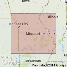
Pg. 122. Permian rocks are known to be represented in Missouri by only a few exposures of massive sandstone in the northwestern corner of the state, in northwestern Atchison County. This sandstone occupies deep channels that have been cut into upper Pennsylvanian beds, and it is identified as the Indian Cave sandstone of early Permian (Wolfcampian) age. The sandstone is fine- to medium-grained, micaceous, and strongly cross-bedded. Fragments of clay-ironstone and limestone occur near the base. Casts and molds of fossil wood also occur in the rock. The sandstone has a maximum thickness of more than 50 feet in the northwestern Missouri outcrops.
Source: Publication.
- Usage in publication:
-
- Indian Cave channel sandstone bed*
- Modifications:
-
- Areal extent
- AAPG geologic province:
-
- Forest City basin
Summary:
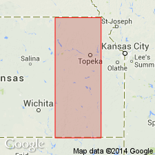
Pg. 5 (fig. 2), 14, 15 (fig. 5), 20. Indian Cave channel sandstone bed of Towle shale member of Onaga shale of Admire group. Incised into Dry shale member of Stotler limestone of Wabaunsee group (Virgil). Age is considered Permian.
Best exposure in NW/4 SW/4 sec. 3, T. 13 S., R. 13 E., [along Mission Creek at Echo Cliff, about 1.5 mi southwest of Dover, approx. Lat. 38 deg. 56 min. 58 sec. N., Long. 95 deg. 57 min. 50 sec. W., Dover 7.5-min quadrangle], Wabaunsee Co., eastern KS.
Authors comment on lack of precise location of type, and mention the 20 to 25 foot-thick massive channel sandstone, very likely of Towle age, exposed in bluff overlooking Missouri River, in center sec. 9, T. 3 N., R. 17 E., Richardson Co., southeastern NE. This sandstone bluff is referred to as the Indian Caves by the local inhabitants.
Source: Publication.
For more information, please contact Nancy Stamm, Geologic Names Committee Secretary.
Asterisk (*) indicates published by U.S. Geological Survey authors.
"No current usage" (†) implies that a name has been abandoned or has fallen into disuse. Former usage and, if known, replacement name given in parentheses ( ).
Slash (/) indicates name conflicts with nomenclatural guidelines (CSN, 1933; ACSN, 1961, 1970; NACSN, 1983, 2005, 2021). May be explained within brackets ([ ]).