The National Geologic Map Database is migrating to a new infrastructure. We apologize for any service disruptions during this process.
|
|---|


- Usage in publication:
-
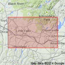
- Indian Castle Member
- Modifications:
-
- Named
- Dominant lithology:
-
- Shale
- AAPG geologic province:
-
- Appalachian basin
Summary:
The Utica Shale is divided in the Mohawk Valley into upper and lower parts by a tongue of the Dolgeville Formation and these parts are here assigned member names. The lower portion of the Utica is named the Flat Creek Member and the upper, the Indian Castle Member. These lithostratigraphic units replace earlier names such as the Canajoharie Shale, which were primarily biostratigraphic. The stratotype of the Indian Castle is designated as the section along Nowadaga Creek and the unit is named for the hamlet of Indian Castle located near the mouth of the Creek. The contact with the underlying Dolgeville is chosen at the level at which the interbedded shales and limestones of the Dolgeville are replaced by a nearly exclusively black shale sequence. Contact with the overlying Frankfort Formation is gradational. Thickness not stated in the article, but as shown in diagram unit appears to be approximately 35 m. East of the basin-ward limit of the Dolgeville (Canajoharie Creek), the Utica Shale is undivided. Between East Canada and West Canada Creeks, the Dolgeville grades into the Denley Limestone and the member name is no longer used. The Utica youngs westward and oversteps the upper Trenton Group. Age of the Indian Castle is Middle and Late Ordovician (Shermanian and Edenian).
Source: GNU records (USGS DDS-6; Reston GNULEX).
For more information, please contact Nancy Stamm, Geologic Names Committee Secretary.
Asterisk (*) indicates published by U.S. Geological Survey authors.
"No current usage" (†) implies that a name has been abandoned or has fallen into disuse. Former usage and, if known, replacement name given in parentheses ( ).
Slash (/) indicates name conflicts with nomenclatural guidelines (CSN, 1933; ACSN, 1961, 1970; NACSN, 1983, 2005, 2021). May be explained within brackets ([ ]).