

- Usage in publication:
-
- Imperial formation
- Modifications:
-
- Original reference
- Dominant lithology:
-
- Sandstone
- AAPG geologic province:
-
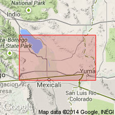
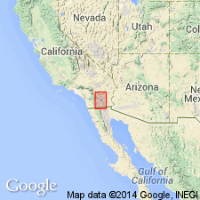
- Salton basin
Summary:
Pg. 434-435. There appears to be good reason to suspect that more than one Pliocene formation is represented on flanks of Coyote Mountain (which is also called Carrizo Mountain). Very little reason exists for placing the coral reef, the lowermost exposed fossiliferous stratum, with the great oyster reefs of upper part. For a long time the deposits about Coyote Mountain have been called "Carrizo Creek beds," or "Carrizo formation," the latter proposed definitely in 1914 by Kew, but F.E. Vaughan has shown that these names are inapplicable because of prior use elsewhere. This is to be regretted, but it seems that current usage demands a different name. Since we are unable as yet to correlate definitely any of the fossil-bearing strata with any named formation elsewhere, I would propose that it be known as Imperial formation. The type locality should be taken where the coral reef exposed in Alverson Canyon on south side of the mountain [Coyote Mountain]. This coral reef has a distinctive fauna. It is succeeded by about 200 feet of very fossiliferous calcareous sandstones for which I propose the name Latrania sands. Above the Latrania sands, are enormous deposits of clay, here named Coyote Mountain clays. Above the clays, and interbedded with them near the top to some extent, are extensive deposits of oyster shells for which the name Yuha Reefs has been selected. According to the above nomenclature, Conrad's fossil mollusks came from the Yuha Reefs; Kew's echinoderms are from the Latrania sands; and Vaughan's corals from Imperial formation. It is believed that further work will necessitate further subdivision rather than a consolidation of above formations.
[According to foregoing the name Imperial formation was proposed as a substitute for "Carrizo Creek beds," but as defined it was also restricted to the coral reef forming basal part of "Carrizo Creek beds."]
Source: US geologic names lexicon (USGS Bull. 896, p. 1007).
- Usage in publication:
-
- Imperial formation*
- Modifications:
-
- Revised
- Adopted
- AAPG geologic province:
-
- Salton basin
Summary:
Pg. 1-25. Redefined Imperial formation, restricting it to marine deposits, and dividing it into an upper or siltstone member (1,400+/- feet thick) and a basal conglomerate member (a few inches to 700 feet thick). He correlated the basal conglomerate member with Imperial formation of Hanna in narrow sense, and the siltstone member with Latrania sands, Coyote Mountain clays, and interbedded Yuha Reefs of Hanna. He assigned his Imperial formation to upper lower Miocene, and his overlying Palm Spring formation (nonmarine) to middle or upper Miocene. [Recognized in Imperial County, southern California. Age is late early Miocene.]
Source: US geologic names lexicon (USGS Bull. 896, p. 1007).
- Usage in publication:
-
- Imperial formation
- Modifications:
-
- Age modified
- AAPG geologic province:
-
- Salton basin
Summary:
Pg. 21 (fig. 4), 22. Imperial formation. Age in doubt. Latest evidence, unpublished, seems to suggest that Pliocene assignment of early workers in preferable to Miocene allocation adopted by some authors. Includes Latrania sand member.
Source: US geologic names lexicon (USGS Bull. 1200, p. 1860).
- Usage in publication:
-
- Imperial formation
- Modifications:
-
- Areal extent
- Dominant lithology:
-
- Mudstone
- Siltstone
- Sandstone
- AAPG geologic province:
-
- Salton basin
Tarbet, L.A., and Holman, W.H., 1944, Stratigraphy and micropaleontology of the west side of Imperial Valley, California [abs.]: American Association of Petroleum Geologists Bulletin, v. 28, no. 12, p. 1781-1782.
Summary:
Pg. 1781-1782. Imperial formation. Marine mudstones, siltstones, and sandstones unconformably overlying all older rocks. Thickness 0 to 3,600 feet. [Is younger than Alverson Canyon formation and older than Palm Spring formation.] Fossils (foraminifers, ostracodes). Age is late Miocene.
Source: US geologic names lexicon (USGS Bull. 1200, p. 1860).
- Usage in publication:
-
- Imperial
- Modifications:
-
- Age modified
- AAPG geologic province:
-
- Salton basin
Durham, J.W., 1950, Megascopic paleontology and marine stratigraphy: Geological Society of America Memoir, 43, pt. 2, 216 p.
Summary:
Pg. 30-33. Imperial formation. Believed that San Marcos and Imperial formations are best assigned to lower Pliocene.
Source: US geologic names lexicon (USGS Bull. 1200, p. 1860).
- Usage in publication:
-
- Imperial formation
- Modifications:
-
- Areal extent
- AAPG geologic province:
-
- Salton basin
Tarbet, L.A., 1951, Imperial Valley, [California]: American Association of Petroleum Geologists Bulletin, v. 35, no. 2, p. 260-263.
Summary:
Pg. 260, 261 (fig. 40), 262. Imperial formation. Subdivided into: upper member, interbedded olive-drab, gray, and tan mudstones, fine-grained sandstone, and fossiliferous reefs, 800 to 1,500 feet; middle member, olive-drab to tan mudstone and siltstone containing few megafossils, 70 to 1,800 feet; and lower member, basal marine sandstone and conglomerate, 5 to 200 feet. Unconformably overlies all older rocks; [shown on generalized columnar section overlying Alverson Canyon formation and underlying Palm Spring formation]. Age is Miocene.
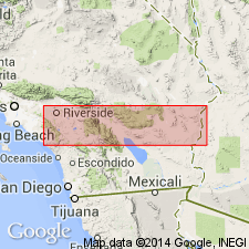
A complete and well exposed section along the prominent wash in northern part of T. 14 S., R. 8 E. (San Bernardino Base and Meridian).
Source: Publication.
- Usage in publication:
-
- Imperial formation
- Modifications:
-
- Mapped
- Dominant lithology:
-
- Sandstone
- Siltstone
- Shale
- AAPG geologic province:
-
- Salton basin
Summary:
Map Sheet 20; GSA Bull., v. 68, no. 3, p. 325 (table 1), 327-328, pl. 3 (geol. map), 1957.
Imperial formation. In San Gorgonio Pass area, [Riverside County, southern California], consists of tan to yellow marine sandstone, siltstone, and shale; gypsiferous; fossiliferous. Thickness about 300 feet. Conformably overlies Hathaway formation (restricted and redefined) and conformably underlies Painted Hill formation (new). Age is considered early Pliocene(?).
[Mapped in small area btw. Millard and Cottonwood Canyons, San Bernardino Mountains, Riverside Co., southern CA (GSA Bull., v. 68, no. 3, pl. 3, 1957).]
Source: Publication; US geologic names lexicon (USGS Bull. 1200, p. 1860).
- Usage in publication:
-
- Imperial formation
- Modifications:
-
- Areal extent
- AAPG geologic province:
-
- Salton basin
Summary:
Pg. 22, 23. Imperial formation. Is series of marine clays and sandstones that lie with essential concordance on Alverson andesite or lava (new), Split Mountain formation, and Fish Creek gypsum (new) , or in some areas, unconformably on basement rocks. Thickness 0 to 3,000 feet. Grades upward into Palm Spring formation. Canebrake conglomerate (new) is coarse marginal conglomerate facies of Imperial and Palm Spring formations. Fossils. Fauna indicates [age of late Miocene or possibly early Pliocene.]
Source: US geologic names lexicon (USGS Bull. 1200, p. 1860).
- Usage in publication:
-
- Imperial Formation*
- Modifications:
-
- Age modified
- AAPG geologic province:
-
- Salton basin
Summary:
Age of the Imperial Formation is latest Miocene to late(?) Pliocene.
Source: GNU records (USGS DDS-6; Menlo GNULEX).
- Usage in publication:
-
- Imperial Formation*
- /Imperial group
- Modifications:
-
- Overview
- AAPG geologic province:
-
- Salton basin
GNC Staff, 2018, [U.S. Geologic Names Committee remarks on Cenozoic geologic units of the Salton Sea area, Imperial and San Diego Cos., southern California]: U.S. Geological Survey, unpublished Geologic Names Committee note
Summary:
In 1957, in an unpub. Master’s thesis (Univ. Calif. Los Angeles) of the Coyote Mountain area , A.D. Christensen subdivided the Imperial Formation into 4 new members (descending): Descanso, Capote, Butaca, and Andrade.
In 1963, in an unpub. PhD dissert. (Univ. Calif. Berkeley) of the Coyote Desert area, G.D. Woodard subdivided the Imperial Formation into 3 new members (descending): Camels Head, Deguynos, and Lycium.
In 1974, G.D. Woodard (AAPG Bull., v. 58, no. 3, p. 522, fig. 2) subdivided the Imperial Formation of the Split Mountain area into upper, middle, and lower members. Underlies Palm Spring Formation; overlies Split Mountain Formation. Age is considered late Miocene(?) to Pliocene.
In 1984, D.R. Kerr (Jour. Sed. Geol., v. 38, nos. 1-4, p. 220, fig. 3) in a study of the Vallecito and Fish Creek Mountains area, stratigraphically extended the Imperial Formation (undivided) downward to base of Woodard's (1974) Fish Creek gypsum (unranked) in lower part of Split Mountain Formation; see entry under Split Mountain. Overlies lower to middle Miocene Anza Formation (revised; see entry under Anza). Age is considered late Miocene.
In 1987, C.D. Winker (unpub. PhD dissert., Univ. Ariz.) subdivided western exposures of Imperial Formation into (descending): Camels Head member of Woodard (1963), Deguynos member (restricted to upper part of Deguynos member of Woodard, 1963), Mud Hills member (new; = lower part of Deguynos member of Woodard, 1963), Wind Caves member (new; = Lycium member of Woodard, 1963), unnamed boulder bed (= upper fanglomerate at top of Split Mountain Formation of Woodard, 1963), and Lycium member (= marine arenite member of Split Mountain Formation of Woodard, 1963). Winker excluded the Fish Creek Gypsum from the basal Imperial, considering it a separate formation underlying the Imperial. Eastern exposures of the Imperial Formation were subdivided into (descending): Camels Head member of Woodard (1963), Deguynos member (restricted to upper part of Deguynos member of Woodard, 1963) and partly equivalent Lavender Canyon member (new), Mud Hills member (new; = lower part of Deguynos member of Woodard, 1963), Latrania member (= Latrania Sands of Hanna, 1926) and interfingering equivalent Kamia Creek member (new). Overlies Alverson Formation.
In 1996, C.D. Winker and S.M. Kidwell (AAPG Pac. Sec. Gdbk., no. 73, SEPM book no. 80, p. 295-335) raised the Imperial to group status and stratigraphically extended it downward to include the Fish Creek Gypsum as its basal formation. The Deguynos, at the top of their Imperial group, is raised to formation rank and subdivided into members (descending): Camels Head, Yuha [=? restricted Yuha Reefs of Hanna, 1926] and partly equivalent Lavender Canyon, and Mud Hills. The underlying Latrania is raised to formation rank and subdivided into members, some are lateral facies (in general descending order): Wind Caves, Jackson Fork [new?], unnamed upper megabreccia, Stone Wash [new?], Lycium, and Adrade [=? restricted Andrade member of Imperial Formation (Christensen, 1957)]. The basal Fish Creek Gypsum is undivided. Underlies their Palm Spring group; overlies their Split Mountain group.
Source: GNC archives
For more information, please contact Nancy Stamm, Geologic Names Committee Secretary.
Asterisk (*) indicates published by U.S. Geological Survey authors.
"No current usage" (†) implies that a name has been abandoned or has fallen into disuse. Former usage and, if known, replacement name given in parentheses ( ).
Slash (/) indicates name conflicts with nomenclatural guidelines (CSN, 1933; ACSN, 1961, 1970; NACSN, 1983, 2005, 2021). May be explained within brackets ([ ]).