The National Geologic Map Database is migrating to a new infrastructure. We apologize for any service disruptions during this process.
|
|---|


- Usage in publication:
-
- Imo formation*
- Modifications:
-
- Named
- Dominant lithology:
-
- Shale
- Sandstone
- AAPG geologic province:
-
- Arkoma basin
Summary:
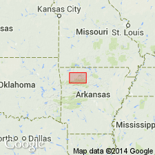
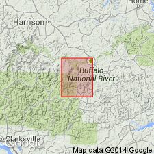
Named for exposures near Imo, Searcy Co, AR, Arkoma basin. Type locality designated in Sulphur Springs Hollow, a tributary of Bear Creek, in the SE1/4 SE1/4 sec 3 and the NW1/4 NW1/4 sec 11, T13N, R17W, Searcy Co. Formation has been mapped in Snowball and Mount Judea quadrangles in parts of Searcy and Newton Cos. Consists largely of grayish-black fossiliferous shale that is somewhat ferruginous in places and weathers dark gray or brown. Commonly massive bed or two of fine-grained calcareous sandstone occurs near base; some fossiliferous calcareous shale rarely containing scattered limestone lenticules occurs in lower one-third. Thickness at type locality is 342 ft. Thickness of lower part that contains marine fossils is roughly 100 ft. Overlies Pitkin limestone. Underlies Witt Spring formation. Fauna of the Imo includes solitary and compound corals, bryozoans, crinoid columnals, pentremities, brachiopods, pelecypods, gastropods, cephalopods, trilobites, and fragments of fish plates. Age given as Mississippian and Pennsylvanian? because of fossils present. Measured sections. Fossil lists. Graphic sections.
Source: GNU records (USGS DDS-6; Denver GNULEX).
- Usage in publication:
-
- Imo Formation†
- Modifications:
-
- Abandoned
- AAPG geologic province:
-
- Arkoma basin
Summary:
Abandoned as a formal name in Arkoma basin and replaced by Cane Hill Formation (raised in rank from Cane Hill Member of Hale Formation).
Source: GNU records (USGS DDS-6; Denver GNULEX).
For more information, please contact Nancy Stamm, Geologic Names Committee Secretary.
Asterisk (*) indicates published by U.S. Geological Survey authors.
"No current usage" (†) implies that a name has been abandoned or has fallen into disuse. Former usage and, if known, replacement name given in parentheses ( ).
Slash (/) indicates name conflicts with nomenclatural guidelines (CSN, 1933; ACSN, 1961, 1970; NACSN, 1983, 2005, 2021). May be explained within brackets ([ ]).