

- Usage in publication:
-
- Imnaitchiak Chert
- Modifications:
-
- Named
- Reference
- Biostratigraphic dating
- Dominant lithology:
-
- Chert
- Mudstone
- Shale
- AAPG geologic province:
-
- Alaska Northern region
Summary:
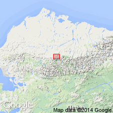
Named as formation in Etivluk Group. Extensively exposed on Picnic Creek allochthon in Imnaitchiak Creek area and in Kurupa Hills. Type locality designated in Kurupa Hills on southwest side of Kurupa River, sec.29 T12S R12W, U.P.M., Killik River quad, northern AK. Reference section is on south side of hill along lower Akmalik Creek, NE/4 sec.27 T12S R10W, U.P.M. Contains rocks previously known as Siksikpuk Formation. Consists dominantly of chert and siliceous mudstone with interbedded siliceous shale and subordinate amounts of siltstones to very fine-grained sandstone, ranging in color from dark gray to greenish-gray in lower part to red, maroon and purple in upper part. Is as much as 250 ft thick. Overlies Akmalik Chert (new); underlies thrust fault in most places, although in few localities underlies Okpikruak Formation. Age is Pennsylvanian to Early Permian based on radiolarians and single conodont, although cherty rocks lithologically similar to Imnaitchiak Chert in the DeLong Mountains contain Triassic fossils. Age of upper part ranges into Middle/Late Triassic (B.L. Murchey, verbal commun.).
Source: GNU records (USGS DDS-6; Menlo GNULEX).
- Usage in publication:
-
- Imnaitchiak Chert*
- Modifications:
-
- Adopted
- Age modified
- Biostratigraphic dating
- AAPG geologic province:
-
- Alaska Northern region
Summary:
Imnaitchiak Chert of Etivluk Group as defined by Mull and others (1987) is adopted. Chert-rich rocks of Siksikpuk Formation now included in Imnaitchiak Chert. Divided into six lithological subunits ascending: (1) greenish gray glauconitic and phosphatic siltstone and sandstone; (2) bedded gray chert; (3) green chert, siltstone, and yellow-orange claystone; (4) interbedded greenish gray or red siltstone and shale; (5) interbedded green and red chert; and (6) violet-gray chert and cherty siltstone. Age is Early Pennsylvanian to Jurassic(?) based on radiolarians and conodonts [and also on regional stratigraphic relations]
Source: GNU records (USGS DDS-6; Menlo GNULEX).
For more information, please contact Nancy Stamm, Geologic Names Committee Secretary.
Asterisk (*) indicates published by U.S. Geological Survey authors.
"No current usage" (†) implies that a name has been abandoned or has fallen into disuse. Former usage and, if known, replacement name given in parentheses ( ).
Slash (/) indicates name conflicts with nomenclatural guidelines (CSN, 1933; ACSN, 1961, 1970; NACSN, 1983, 2005, 2021). May be explained within brackets ([ ]).