The National Geologic Map Database is migrating to a new infrastructure. We apologize for any service disruptions during this process.
|
|---|


- Usage in publication:
-
- Imnaha Formation
- Modifications:
-
- Named
- AAPG geologic province:
-
- Blue Mountains province
- Snake River basin
Summary:
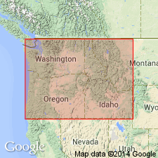
Imnaha Formation. Overlies Permian strata unconformably near Fish Lake in western part of area. Doyle Creek Formation (new) may interfinger with the Imnaha east of Fish Lake. Is Upper Triassic (Karnian). Mapped area lies between Wallowa Mountains of northeastern Oregon and Seven Devils Mountains of western Oregon. Part of Snake River Canyon included.
Source: US geologic names lexicon (USGS Bull. 1350, p. 357).
- Usage in publication:
-
- Imnaha River Basalt
- Modifications:
-
- [Overview]
- Dominant lithology:
-
- Basalt
- AAPG geologic province:
-
- Columbia basin
- Blue Mountains province
Summary:
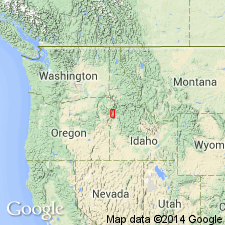
Imnaha River Basalt [incorrectly used name] is older member of Columbia River Group in Hells Canyon area, Idaho-Oregon border. Generally has massive columnar jointing, forming steep bold outcrops; in hand specimens displays large phenocrysts and porphyritic texture. Extends to about 1000 feet above Brownlee Reservoir. Underlies Yakima Basalt (also of Columbia River Group). Age is Miocene.
Source: GNU records (USGS DDS-6; Menlo GNULEX).
- Usage in publication:
-
- Imnaha Basalt*
- Modifications:
-
- Adopted
- Revised
- Reference
- Paleomagnetics
- Dominant lithology:
-
- Basalt
- AAPG geologic province:
-
- Columbia basin
- Blue Mountains province
Summary:
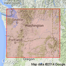
Pg. G2 (fig. 1), G4 (table 1), G6 (fig. 2), G8-G9, G10-11 (table 2), 12. Imnaha Basalt, lowermost formation of Columbia River Basalt Group. Imnaha Formation of Vallier (1967) formally redefined and adopted by the USGS as Imnaha Basalt. The Imnaha Basalt was informally applied by Hooper (1974), following a suggestion by Taubeneck (1970); replaces informal "lower basalt" of Bond (1963) and Wright and others (1973), and part of Waters' (1961, p. 608) Picture Gorge Basalt. At type (described by Kleck, 1976, and Vallier and Hooper, 1976), consists of 14 flows; total thickness approx. 500 m (base not exposed). Most flows are coarse-grained, plagioclase-phyric; weather to grus owing to their coarse grain size and abundance of secondary minerals. Many flows contain zeolite amygdules; smectite alteration is widespread. Contains 4 informal magnetostratigraphic units of reversed (R), transitional (T), and normal (N) polarities; called (ascending) R0(?), N0, T, R1. Oldest flow, R0(?), on China Cap Ridge, Wallowa Mountains (see fig. 1, loc. 35), tentatively identified as magnetically reversed (citing Taubeneck and others, unpub. portable fluxgate magnetometer data, 1976). Most flows have normal magnetic polarity (citing Hooper and others, 1976; Hooper and others, 1979). Includes informal Rock Creek flow (of Hooper, 1974; see also Kleck, 1976, and Bond, 1963). Conformably underlies Grande Ronde Basalt (new); contact is commonly marked by distinct topographic break between grus-covered slopes developed in the Imnaha and bold cliffs in the fine-grained and generally fresher Grande Ronde. Overlies pre-Tertiary metamorphic and plutonic rocks along rugged erosional unconformity having local relief of more than 500 m; some flows approx. 120 m thick as a result of local ponding on irregular surface. Areal extent map shows inferred original distribution in northeast Oregon and adjacent Washington and Idaho (see pl. 1, fig. A). Feeder dikes found along Imnaha River in extreme northeast Oregon (citing Kleck, 1976); inferred feeder dikes in western Idaho and northeast Oregon (citing Taubeneck and others, unpub. data, 1978). Age is early Miocene. [Imnaha Formation of Vallier (1967) adopted by the USGS as Imnaha Basalt as used by Taubeneck (1970) and Hooper (1974) and assigned to Columbia River Basalt Group as its lowermost formation (USGS Bull. 1502-A).]
Type [section] (see fig. 1, loc. 3 and pl. 1, fig. A): exposures (base of formation not exposed) in cliffs on west side of Snake River above north end of Dug Bar, Cactus Mountain quadrangle, Wallowa Co., OR. Is reached by boat or by a dirt road down the Imnaha Valley from town of Imnaha, OR. Base of formation seen at south end of Dug Bar, where basalt unconformably overlies deformed pre-Tertiary rocks.
Type locality (of Hooper, 1974; see fig. 1, loc. 3, this report): at Dug Bar, on Snake River near the mouth of Imnaha River in extreme northeast Oregon.
Reference localities: (1) near confluence of Lower [Little?] Sheep Creek and Imnaha River near town of Imnaha, OR (Kleck, 1976); (2) core of faulted anticline forming north side of Lewiston basin, particularly near center T. 11 N., R. 45 E. (Camp, 1976); and (3) lower part of Rocky Canyon, in SE/4 sec. 18, T. 30 N., R. 1 W., 25 km west of Grangeville, ID, in Salmon River drainage (Holden and Hooper, 1976).
References cited:
Bond, J.G., 1963, Idaho Bur. Mines and Geol. Pamphlet, no. 128, 83 p.
Camp, V.E., 1976, Washington State Univ. PhD dissert., 201 p.
Holden, G.S., and Hooper, P.R., 1976, GSA Bull., v. 87, p. 215-225.
Hooper, P.R., 1974, GSA Bull., v. 85, p. 15-26.
Hooper, P.R., and others, 1976, GSA Abs. w/ Prog., v. 8, no. 3, p. 383.
Hooper, P.R., and others, 1979, Amer. Jour. Sci. (in press).
Kleck, W.D., 1976, Washington State Univ. PhD dissert., 203 p.
Taubeneck, W.H., 1970, IN Gilmour, E.H., and Stradling, Dale, eds., Proc. 2nd Columbia River Basalt Symp., Eastern Washington State Coll. Press, p. 73-96.
Vallier, T.L., 1967, Dissert. Abs., Sec. B, v. 28, no. 4, p. 1585.
Vallier, T.L., and Hooper, P.R., 1976, GSA, Cordilleran Sect. Mtg., Field Guide No. 5, 38 p.
Waters, A.C., 1961, Amer. Jour. Sci., v. 259, p. 583-611.
Wright, T.L., and others, 1973, GSA Bull., v. 84, p. 371-386.
Source: Publication; GNU records (USGS DDS-6; Menlo GNULEX); US geologic names lexicon (USGS Bull. 1564, p. 80); Changes in stratigraphic nomenclature, 1979 (USGS Bull. 1502-A, p. A35).
For more information, please contact Nancy Stamm, Geologic Names Committee Secretary.
Asterisk (*) indicates published by U.S. Geological Survey authors.
"No current usage" (†) implies that a name has been abandoned or has fallen into disuse. Former usage and, if known, replacement name given in parentheses ( ).
Slash (/) indicates name conflicts with nomenclatural guidelines (CSN, 1933; ACSN, 1961, 1970; NACSN, 1983, 2005, 2021). May be explained within brackets ([ ]).