The National Geologic Map Database is migrating to a new infrastructure. We apologize for any service disruptions during this process.
|
|---|


- Usage in publication:
-
- Ilo formation*
- Modifications:
-
- Named
- Dominant lithology:
-
- Sandstone
- Shale
- AAPG geologic province:
-
- Bighorn basin
Summary:
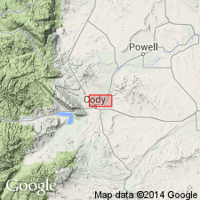
Named for exposures on west side Bighorn basin in valley northwest of town of Ilo, 50 mi southeast of Cody, Park Co, WY. No type locality designated. Overlies Meeteetse formation (new). Underlies Fort Union formation unconformably. Section 1,790 ft thick measured on the Shoshone River where formation is composed of white, buff to olive sandstone that may be argillaceous, unconsolidated, and has some conglomerate near top. Also has carbonaceous shale and one thin bed of gray sandy clay. Top placed approximately 400 ft below lowest conglomerate of the Fort Union. Thought to be equivalent to Lance formation. Vertebrate and freshwater invertebrate fossils listed. Stratigraphic chart and sections. Questionably assigned to the Cretaceous or Tertiary.
Source: GNU records (USGS DDS-6; Denver GNULEX).
For more information, please contact Nancy Stamm, Geologic Names Committee Secretary.
Asterisk (*) indicates published by U.S. Geological Survey authors.
"No current usage" (†) implies that a name has been abandoned or has fallen into disuse. Former usage and, if known, replacement name given in parentheses ( ).
Slash (/) indicates name conflicts with nomenclatural guidelines (CSN, 1933; ACSN, 1961, 1970; NACSN, 1983, 2005, 2021). May be explained within brackets ([ ]).