

- Usage in publication:
-
- Idenbro limestone member
- Modifications:
-
- Named
- Dominant lithology:
-
- Limestone
- AAPG geologic province:
-
- Cherokee basin
Summary:
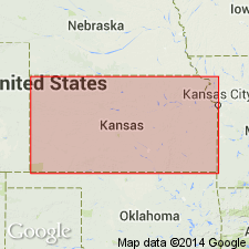
Named as uppermost member (of 3) of Lenapah limestone of Marmaton group in southeastern KS; named from Idenbro, a station on the Missouri, Kansas, and Texas railroad about 4 mi southwest of Parsons, Labette Co, KS. Type exposure 3 ft thick designated along drainage in SW sec 2, T32S, R18E, east and west of Idenbro, Labette Co in the Cherokee basin. Other measured sections. Identified northward into Linn Co. Consists of limestone, light in color, crystalline, and marked by irregular, wavy beds. Is somewhat fossiliferous, corals being prominent. Much algal material exists, especially in upper part. Weathered surfaces are nearly white. Thickness averages 6 ft, but is greater near KS-OK line in Montgomery Co. Overlies Perry Farm shale member (new) of Lenapah limestone of Marmaton group; underlies Memorial shale of Marmaton. Cross section. Of Pennsylvanian, Des Moines age.
Source: GNU records (USGS DDS-6; Denver GNULEX).
For more information, please contact Nancy Stamm, Geologic Names Committee Secretary.
Asterisk (*) indicates published by U.S. Geological Survey authors.
"No current usage" (†) implies that a name has been abandoned or has fallen into disuse. Former usage and, if known, replacement name given in parentheses ( ).
Slash (/) indicates name conflicts with nomenclatural guidelines (CSN, 1933; ACSN, 1961, 1970; NACSN, 1983, 2005, 2021). May be explained within brackets ([ ]).