The National Geologic Map Database is migrating to a new infrastructure. We apologize for any service disruptions during this process.
|
|---|


- Usage in publication:
-
- Iberville formation
- Modifications:
-
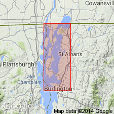
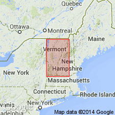
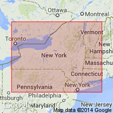
- Areal extent
- Dominant lithology:
-
- Shale
- Dolomite
- AAPG geologic province:
-
- New England province
Summary:
Geographically extended the Iberville formation from southern Quebec, CAN into northwestern VT. Consists of noncalcareous shale, rhythmically interbedded with thin quartz-silty dolomite, uniform fine-grained dolomite, and in lower part, calcareous shale. Thickness is 1000 to 2000 feet. Overlies the Stony Point formation and underlies the Hathaway formation. The Iberville is of Middle Ordovician age.
Source: GNU records (USGS DDS-6; Reston GNULEX).
- Usage in publication:
-
- Iberville formation
- Modifications:
-
- Revised
- AAPG geologic province:
-
- New England province
Summary:
Included the Iberville formation in the Trenton group. Consists of noncalcareous shale interbedded with occasional dolomite beds and, in the lower part, with calcareous shale. Overlies the Stony Point formation and underlies the Hathaway formation. The Iberville is of Middle Ordovician age.
Source: GNU records (USGS DDS-6; Reston GNULEX).
- Usage in publication:
-
- Iberville shale
- Modifications:
-
- Revised
- Areal extent
- AAPG geologic province:
-
- New England province
Summary:
Geographically extended and revised the Iberville to the Iberville shale in NY.
Source: GNU records (USGS DDS-6; Reston GNULEX).
For more information, please contact Nancy Stamm, Geologic Names Committee Secretary.
Asterisk (*) indicates published by U.S. Geological Survey authors.
"No current usage" (†) implies that a name has been abandoned or has fallen into disuse. Former usage and, if known, replacement name given in parentheses ( ).
Slash (/) indicates name conflicts with nomenclatural guidelines (CSN, 1933; ACSN, 1961, 1970; NACSN, 1983, 2005, 2021). May be explained within brackets ([ ]).