

- Usage in publication:
-
- Hyrum dolomite member
- Modifications:
-
- Original reference
- Dominant lithology:
-
- Dolomite
- Limestone
- Sandstone
- AAPG geologic province:
-
- Wasatch uplift
Summary:
Pg. 1139, 1140. Hyrum dolomite member of Jefferson formation. Predominantly black dolomite and limestone; minor amounts of calcareous sandstone. Thickness 840 to 1,200 feet. Underlies Beirdneau sandstone member (new), contact gradational; disconformably overlies Water Canyon formation (new). Age is Devonian.
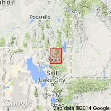
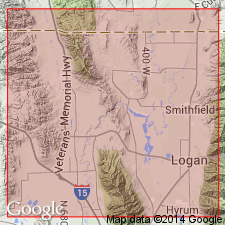
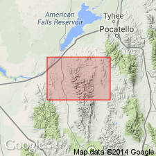
Named from exposures in mouth of Blacksmith Fork Canyon, east of town of Hyrum, in sec. 7, T. 10 N., R. 2 E., [Paradise 7.5-min quadrangle], Cache Co., northern UT.
Source: US geologic names lexicon (USGS Bull. 1200, p. 1850).
- Usage in publication:
-
- Hyrum Dolomite Member*
- Modifications:
-
- Areal extent
- AAPG geologic province:
-
- Wasatch uplift
Summary:
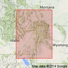
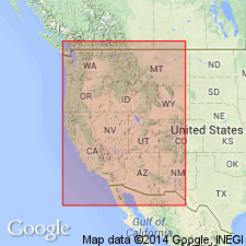
Extended geographically into southeast ID. Mapped as the lower member of the Jefferson Dolomite in the northeastern part of the quad in Ts9 and 10S, R39E, Caribou Co, ID on the Wasatch uplift. Is 1,650 ft thick. Divisible into lower part and an upper part. Upper part marked at base by a conspicuous dolomite that weathers very light gray to white several hundred ft thick. Of Late Devonian age.
Source: GNU records (USGS DDS-6; Denver GNULEX).
- Usage in publication:
-
- Hyrum Dolomite†
- Modifications:
-
- Abandoned
Summary:
Recommends unit be abandoned because Hyrum is an infrequently used term that is synonymous with Jefferson Formation. Jefferson has been traced from its type section in southwest MT to northeast UT (Wasatch uplift) and Hyrum corresponds in lithologic character and stratigraphic position with Jefferson.
Source: GNU records (USGS DDS-6; Denver GNULEX).
- Usage in publication:
-
- Hyrum Formation
- Modifications:
-
- Revised
- AAPG geologic province:
-
- Wasatch uplift
- Great Basin province
Summary:
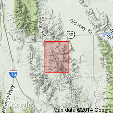
Samaria Limestone Member of Jefferson Formation reassigned as basal member of Hyrum Formation [no explanation included]. Author removed section below the lowest limestone ledge of the type Samaria from the Samaria and reassigned it to the underlying Lower Devonian Water Canyon Formation. The Samaria is thus restricted to beds 6 to 15 of Beus' type at Portage, Box Elder Co, UT in the Great Basin province. The Middle-Upper Devonian boundary occurs about 100 ft above the revised Samaria at Portage and about 45 to 80 ft above the base of the Samaria at Logan Canyon, Cache Co, UT on the Wasatch uplift. Columnar sections.
Source: GNU records (USGS DDS-6; Denver GNULEX).
- Usage in publication:
-
- Hyrum Dolomite*
- Modifications:
-
- Revised
- Areal extent
- AAPG geologic province:
-
- Snake River basin
Summary:
Geographically extended to the Snake River basin where it is raised to formation rank in Power Co, ID. Crops out extensively. Geologic map. Is 542 ft thick. Lower contact placed at base of lowest very dark gray or black dolomite. AMPHIPHORA where present aid in recognition of formation. The underlying dolomite of the Laketown Dolomite is lighter-colored. Underlies Beirdneau Formation (rank raised). Measured section. Of Late Devonian age.
Source: GNU records (USGS DDS-6; Denver GNULEX).
- Usage in publication:
-
- Hyrum Dolostone*
- Modifications:
-
- Redescribed
- Dominant lithology:
-
- Dolostone
- AAPG geologic province:
-
- Great Basin province
Summary:
Is redescribed as dolostone. The name "dolostone" is used for rocks composed predominantly of the mineral "dolomite" on Figure 2 and throughout this chapter, although in the literature it has been common practice to use dolomite rather than dolostone in formal names of dolomitic formations and members. Occurs in stratigraphic column for north-central UT (Great Basin province). Unconformably above Water Canyon Formation (Lower Devonian); conformably below Beirdneau Formation (Upper Devonian). Assigned to Givetian (Middle Devonian) and Frasnian (Upper Devonian).
Source: GNU records (USGS DDS-6; Denver GNULEX).
For more information, please contact Nancy Stamm, Geologic Names Committee Secretary.
Asterisk (*) indicates published by U.S. Geological Survey authors.
"No current usage" (†) implies that a name has been abandoned or has fallen into disuse. Former usage and, if known, replacement name given in parentheses ( ).
Slash (/) indicates name conflicts with nomenclatural guidelines (CSN, 1933; ACSN, 1961, 1970; NACSN, 1983, 2005, 2021). May be explained within brackets ([ ]).