The National Geologic Map Database is migrating to a new infrastructure. We apologize for any service disruptions during this process.
|
|---|


- Usage in publication:
-
- Hygiene sandstone member*
- Modifications:
-
- Named
- Dominant lithology:
-
- Sandstone
- AAPG geologic province:
-
- Denver basin
Summary:
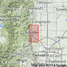
Named as a member of the Pierre formation for exposures about 1 1/2 mi west of town of Hygiene, Boulder Co, CO in Denver basin. No type locality designated. Is a well known unit on Culver Ranch, 6 mi southwest of Berthoud where a ridge formed by the Hygiene crosses Little Thompson Creek and where there is an oil seep. Mapped as a separate unit from rest of Pierre from Lykins Gulch south to Boulder. Several outliers shown to east and to south of outcrop belt that extends from north edge of map to city of Boulder. Lies about one-third way up from base. Forms a prominent ridge. Is underlain and overlain by gray to black shale of the Pierre. Is a thick-bedded, frequently cross bedded, dark greenish-gray, calcareous sandstone. Invertebrate fossils identified. Contains carbonaceous material. Is 250 ft thick at north edge of area. Hygiene? is 150 ft thick at Bear Canyon. Thickens north of Boulder. Large concretions several ft in diameter present in upper part. Of Cretaceous age.
Source: GNU records (USGS DDS-6; Denver GNULEX).
- Usage in publication:
-
- Hygiene sandstone
- Modifications:
-
- Revised
- AAPG geologic province:
-
- Denver basin
Summary:
Name applied for many years to a sandstone in Pierre shale, and the name was applied to every sandstone in the Pierre in report area, Larimer Co, CO in the Denver basin. Author recognizes five different sandstones belonging to the Pierre. The name Hygiene is applied to the basal sandstone. The younger sandstones in sequence are the Terry, Rocky Ridge, Larimer, and Richard. Each sandstone is separated by an interval of shale.
Source: GNU records (USGS DDS-6; Denver GNULEX).
- Usage in publication:
-
- Hygiene sandstone member*
- Modifications:
-
- Revised
- AAPG geologic province:
-
- Denver basin
Summary:
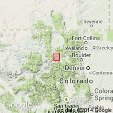
Recognized as the oldest of five sandstones reassigned as a member of Pierre shale rather than as an unranked unit in the Mesaverde formation. Lies 3,094 ft above base of Pierre in a measured section on Fossil Creek south of Fort Collins. Is separated from the next younger sandstone, the Terry sandstone member of Pierre, by 200 to 400 ft of sandy shale. Consists of 132 ft of gray massive cross-bedded sandstone and shaly sandstone. Varies in coarseness of grain. Has carbonaceous matter and marine invertebrate fossils at some localities. The name was mistakenly applied to several sandstones of Pierre in earlier reports until Ball (1924) restricted Hygiene to the lowest of the sandstones of his Mesaverde. Can be traced continuously between Fort Collins and Boulder, CO. Is best developed and exposed between Loveland and Boulder. Averages 100 ft thick. Geologic map. Not separately mapped from the Pierre. Pierre forms extensive outcrops in Larimer, Morgan, and Washington Cos, CO in the Denver basin. Of Late Cretaceous age.
Source: GNU records (USGS DDS-6; Denver GNULEX).
- Usage in publication:
-
- Hygiene Sandstone Member*
- Modifications:
-
- Areal extent
- AAPG geologic province:
-
- North Park basin
- Denver basin
Summary:
Is extended from Boulder area, CO into north-central CO to North Park basin as a member of the Pierre Shale. Is a cliff-forming sandstone near Kremmling as much as 120 ft thick about 3,200 ft above base of Pierre. Lower part is massive, very fine-grained sandstone that contains brown-weathering sandy limestone concretions (up to 8 ft in diameter). Upper part is soft slope-forming thin-bedded sandstone. Thickness of member is variable because of gradational lower contact. Upper contact placed at topmost thin-bedded ledge-forming calcareous sandstone. Lies within the Range Zone of BACULITES SCOTTI which is in late Campanian or part of Late Cretaceous. Correlation with units in Iles Formation in Hamilton area, CO shown on figure 2.
Source: GNU records (USGS DDS-6; Denver GNULEX).
- Usage in publication:
-
- Hygiene Sandstone Member*
- Modifications:
-
- Mapped 1:24k (Indian Hills quad, Jefferson Co, CO)
- Dominant lithology:
-
- Sandstone
- Limestone
- AAPG geologic province:
-
- Denver basin
Summary:
Is Upper Cretaceous middle member of Pierre Shale mapped in central Jefferson Co, CO (Denver basin). Outcrops in northeast part of quad. Pierre divided into (ascending) lower part, Hygiene, and upper part. Hygiene described as dusky-yellow to light-yellowish-brown thin-bedded friable sandstone containing scattered to abundant limestone concretions and beds between BACULITES GREGORGENSIS and ANAPACHYDISCUS COMPLEXUS zones; about 370 ft thick.
Source: GNU records (USGS DDS-6; Denver GNULEX).
- Usage in publication:
-
- Hygiene Sandstone Member*
- Modifications:
-
- Areal extent
- AAPG geologic province:
-
- Denver basin
Summary:
Geographically extended northward to Laramie Mountains of WY. Replaces use of Sussex Sandstone Member in Denver basin. Recognized at Francis Ranch on the outcrop in Ts14 and 15N, R69W, Laramie Co, WY and in the subsurface in Apache Co., 1 Polo Ranch in sec 14, T14N, R66W, Laramie Co, WY. Is a member of Pierre Shale 400+ ft thick that is divisible into a lower part of gray sandy shale and gray to orange siltstone with nonfossiliferous limestone concretions and locally fossiliferous calcareous siltstone concretions 275 ft thick, and an upper part of salt-and-pepper, fine- to medium-grained sandstone and interbedded gray, orange, very fine to fine grained, slightly cross bedded, friable sandstone 128.7 ft thick. Overlies and underlies unnamed parts of the Pierre. Stratigraphic chart; measured section. Campanian age.
Source: GNU records (USGS DDS-6; Denver GNULEX).
- Usage in publication:
-
- Hygiene Sandstone Member
- Modifications:
-
- Overview
- AAPG geologic province:
-
- Denver basin
Summary:
Is a sandstone in the middle part of the Pierre Shale in the Denver basin that was deposited as an offshore shelf bar in shallow marine water south of the Parkman delta. South tracking storms moved sediments from the delta front in south-central WY 80 mi south, depositing then over north-central CO. Four facies recognized: 1 and 2) bioturbated, sandy mudstone and muddy sandstone; 3) fine- to medium-grained, nonburrowed, cross-stratified sandstone containing mudstone drapes; and 4) burrowed cross-stratified sandstone. Is a coarsening-upward sequence. Diagenesis described. Cross sections. Of late Campanian, Late Cretaceous age. Name Shannon Sandstone Member [of Steele Shale] has been erroneously applied to this sandstone which is younger than Shannon.
Source: GNU records (USGS DDS-6; Denver GNULEX).
For more information, please contact Nancy Stamm, Geologic Names Committee Secretary.
Asterisk (*) indicates published by U.S. Geological Survey authors.
"No current usage" (†) implies that a name has been abandoned or has fallen into disuse. Former usage and, if known, replacement name given in parentheses ( ).
Slash (/) indicates name conflicts with nomenclatural guidelines (CSN, 1933; ACSN, 1961, 1970; NACSN, 1983, 2005, 2021). May be explained within brackets ([ ]).