

- Usage in publication:
-
- Hyde formation
- Modifications:
-
- Original reference
- Dominant lithology:
-
- Sandstone
- AAPG geologic province:
-
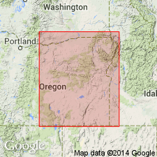
- Snake River basin
Summary:
Pg. 227 (table 1), 229, 255-259. Hyde formation of Izee group. More than 1,000 feet of massive blue-gray sandstones in lower part of Izee group. Underlies Snowshoe formation (new); overlies Warm Springs formation of Colpitts group (both new). Age is Middle Jurassic.
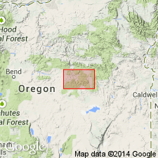
Type area: at South Fork Bridge, in sec. 30, T. 17 S., R. 28 E., in bottom of South Fork Valley. Named from John Hyde Ranch at mouth of Poison Creek, Crook Co., east-central OR.
Source: US geologic names lexicon (USGS Bull. 1200, p. 1849).
- Usage in publication:
-
- Hyde Formation*
- Modifications:
-
- Overview
- AAPG geologic province:
-
- Snake River basin
Summary:
Pg. C4, C6, C7, C10 (fig. 3), C22. Hyde Formation. Hyde Formation of Lupher (1941, p. 255, 256), as mapped by Dickinson (1962a, p. 483-486), and Dickinson and Vigrass (1965, p. 31, 32, 41, 43), consists of 1,000-1,500 feet of thick-bedded to massive andesitic marine tuff and volcanic graywacke that form prominent ridges in area of drainage of the South Fork of John Day River. Minor constituents include dark volcanic siltstone and mudstone that are poorly fossiliferous. Top of formation is marked by a thin unit of calcareous volcanic sandstone that grades fairly abruptly into the Snowshoe Formation of Lupher, 1941 (Dickinson, written commun., Feb. 1966). Overlies and intertongues with Nicely Shale of Lupher (1941); intertonguing of the dark shaly units typical of the Nicely Shale with units of volcanic sandstone typical of Lupher's Hyde Formation makes selection of the exact boundary difficult in some sections. No ammonites were recovered from the Hyde Formation. Age is late Early Jurassic (early Toarcian), based on stratigraphic relations. In east-central Oregon, near Izee and Seneca, late Toarcian ammonites were obtained from the basal 125 feet of the Snowshoe Formation; late Pliensbachian ammonites recovered from the Nicely Shale. Report includes correlation charts, fossil plates, maps showing fossil localities, charts showing distribution of ammonite genera and species.
Source: Publication.
- Usage in publication:
-
- Hyde Formation
- Modifications:
-
- Overview
- AAPG geologic province:
-
- Snake River basin
Summary:
Pg. 4, 30, 39-40. Hyde Formation. Defined and assigned to Izee Group by Lupher (1941) who designated exposures at South Fork Bridge on South Fork of John Day River, in sec. 30, T. 17 S., R. 28 E., Suplee-Izee district, central Oregon, as the type locality. Near juncture of Freeman Creek and South Fork of Beaver Creek (12 miles southwest of type locality), Lupher (1941) assigned fossiliferous strata to the Hyde Formation on basis of lithology, and since the fossils and stratigraphic position indicated strata was post-Mowich in age, he assigned the Hyde to the Izee Group. Detailed mapping by Dickinson and Vigrass (1965) revealed Lupher's (1941) "incertae sedis beds," which unconformably underlie his Hyde Formation and conformably overlie Nicely Shale of Mowich Group, are laterally continuous with the type Hyde. They assigned these beds to the Hyde Formation and, due to the conformable relationship with the underlying Nicely Shale, included their Hyde Formation in the Mowich Group. Lupher's (1941) Hyde Formation, in this area, is called Basey Member of Snowshoe Formation. (See also entries under Basey and Mowich.)
Hyde Formation crops out as narrow band extending for 20 miles in northeasterly direction through center of Suplee-Izee district, central Oregon. Described as 700 to 1,500 feet of resistent, massive, blue-gray andesitic marine tuff and tuffaceous volcanic graywacke intercalated with subordinate dark, laminated, volcanic siltstone and mudstone. Sandstone is moderately sorted, medium-grained, and shardy. Consists of (in order of abundance) clastic andesitic debris, nonvolcanic quartz, chert, and argillite. Mudstone is most abundant in western part of Suplee area and in eastern part of Izee area. In Izee area, conformably overlies Nicely Shale and conformably underlies Snowshoe Formation. Unconformably underlies Snowshoe in Suplee area, near juncture of Freeman Creek and South Fork of Beaver Creek. Age is Middle Jurassic; is late Toarcian according to Dickinson and Vigrass (1965) and early Toarcian according to Imlay (1968).
See also Dickinson, W.R., and Vigrass, L.W., 1965, "Geology of the Suplee-Izee area, Cook, Grant, and Harney Counties, Oregon," Oregon Dept. Geol. and Min. Ind. Bull., no. 58, 109 p., geol. map (scale 1:42,000).
Source: Publication.
For more information, please contact Nancy Stamm, Geologic Names Committee Secretary.
Asterisk (*) indicates published by U.S. Geological Survey authors.
"No current usage" (†) implies that a name has been abandoned or has fallen into disuse. Former usage and, if known, replacement name given in parentheses ( ).
Slash (/) indicates name conflicts with nomenclatural guidelines (CSN, 1933; ACSN, 1961, 1970; NACSN, 1983, 2005, 2021). May be explained within brackets ([ ]).