

- Usage in publication:
-
- Huot Formation
- Modifications:
-
- Original reference
- Dominant lithology:
-
- Clay
- AAPG geologic province:
-
- Sioux uplift
- Williston basin
Summary:
Pg. 5 (fig. 2), 7 (fig. 3), 16-17, 30-31, 35, 37 (measured sections). Huot Formation. Gray and very dark-grayish-brown, unbedded clay, silt, and sand. Contains pebbles and cobbles and numerous tan, chalky inclusions (from 2 mm to 1+ cm size); locally contains boulder-size inclusions of yellow calcareous glacial sediment. The Huot is very hard and blocky when dry and very plastic when moist. Is prone to slumping. Slickensides typically occur on shear faces. Thickness up to 100 feet; most exposures 3 to 20 feet thick. [Occurs in Traill County, North Dakota, and Norman, Pennington, Polk, and Red Lake Counties, Minnesota.] Overlies Wylie Formation (new); contact is gradually interbedded to diffuse, locally is highly contorted. Underlies Brenna Formation (new); contact not observed but is believed to be conformable and gradational. Laterally grades into the Falconer Formation (new). Deposited by readvance of a glacier into Lake Agassiz (same glacier that deposited the Falconer); the Edinburg Moraine in Traill, Grand Forks, and Walsh Counties, North Dakota, marks limit of this glacial advance. Age is considered late Pleistocene (latest Wisconsinan); deposited about 13,500 yr B.P. or 12,800 yr B.P.
[Localities are taken from measured section descriptions (p. 30-31, 35, 37); some differ from what is given in text.]
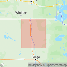
Type section: Clearwater section, right bank of Clearwater River, Red Lake Falls area, in NE/4 NE/4 sec. 22, T. 151 N., R. 44 W., Red Lake Falls 15-min quadrangle, Red Lake Co., northwestern MN.
Reference sections, in Red Lake Falls area, Red Lake Falls 15-min quadrangle, Red Lake Co., northwestern MN: (1) Snake Curve North section, right bank of Red Lake River, in NW/4 SW/4 sec. 18, T. 151 N., R. 44 W.; and (2) Schist Cliff section, right bank of Red Lake River, in southeastern corner sec. 22 [? cliffs in northwestern corner sec. 26], T. 151 N., R. 45 W.
Named from hamlet of Huot, Red Lake Falls 15-min quadrangle, Red Lake Co., northwestern MN.
Source: Publication.
For more information, please contact Nancy Stamm, Geologic Names Committee Secretary.
Asterisk (*) indicates published by U.S. Geological Survey authors.
"No current usage" (†) implies that a name has been abandoned or has fallen into disuse. Former usage and, if known, replacement name given in parentheses ( ).
Slash (/) indicates name conflicts with nomenclatural guidelines (CSN, 1933; ACSN, 1961, 1970; NACSN, 1983, 2005, 2021). May be explained within brackets ([ ]).