The National Geologic Map Database is migrating to a new infrastructure. We apologize for any service disruptions during this process.
|
|---|


- Usage in publication:
-
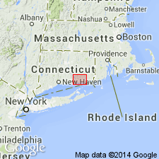
- Hunts Brook Schist
- Modifications:
-
- Named
- Dominant lithology:
-
- Schist
- Gneiss
- AAPG geologic province:
-
- New England province
Summary:
Hunts Brook Schist, uppermost unit in the Waterford Complex, informally named by Goldsmith (1985), is here formalized for all schistose rocks on the north and east side of the Lyme dome and equivalent rocks with the type locality as described by Dixon and others (1986 [1968]), Stop 1: CT Guidebook, no. 2, FT F-4). [Rocks were described by Dixon and others as equivalent to Brimfield Schist and Tatnic Hill Formations.] These rocks were also assigned to the Brimfield Schist by Goldsmith (1967) and later correlated with Putnam-Nashoba rocks by Rogers (1985). Schists and gneisses of Huntsbrook Schist here described as strongly layered, well foliated, and blastomylonitic. They contain plagioclase, quartz, and biotite with variable amounts of sillimanite, magnetite, and K-feldspar. Composition varies widely. Amphibolite bodies are present, but rare. Adjacent to Rope Ferry Gneiss and interpreted as fault rocks derived from that unit. Called lithodemic orthoschists. Does not correlate with Tatnic Hill Formation or Brimfield Schist as suggested by previous workers. Contact with underlying Rope Ferry is probably gradational, not unconformable as previously suggested. Age shown as Late Proterozoic.
Source: GNU records (USGS DDS-6; Reston GNULEX).
For more information, please contact Nancy Stamm, Geologic Names Committee Secretary.
Asterisk (*) indicates published by U.S. Geological Survey authors.
"No current usage" (†) implies that a name has been abandoned or has fallen into disuse. Former usage and, if known, replacement name given in parentheses ( ).
Slash (/) indicates name conflicts with nomenclatural guidelines (CSN, 1933; ACSN, 1961, 1970; NACSN, 1983, 2005, 2021). May be explained within brackets ([ ]).