


- Usage in publication:
-
- Huntington limestone
- Modifications:
-
- Named
- Dominant lithology:
-
- Limestone
- Dolomite
- AAPG geologic province:
-
- Cincinnati arch
Summary:
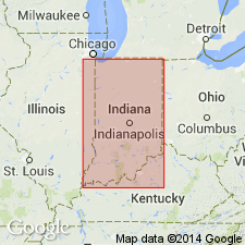
Name Huntington limestone introduced here for light-gray or cream-colored granular dolomitic limestone of saccharoidal texture, 150 to about 100 ft thick, of which 80 ft are exposed at Huntington. Contains Guelph fauna, a younger fauna than Noblesville dolomite, which contains Lockport fossils, and also differs decidedly in physical appearance from the Huntington. Both belong to the Niagara. It will be convenient to designate the beds exposed in the Huntington quarries as Huntington limestone. The same limestone is also exposed in the lime quarries northeast of Delphi. At one place near Delphi it is unconformably overlain by beds of Hamilton age. Age is Silurian.
Source: GNU records (USGS DDS-6; Reston GNULEX).
- Usage in publication:
-
- Huntington dolomite
- Modifications:
-
- Revised
- AAPG geologic province:
-
- Cincinnati arch
Summary:
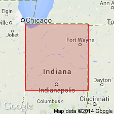
The name Huntington limestone was proposed by Kindle for "the beds exposed in the Huntington quarries." Since several distinct formations, complicated by a great coral reef plexus, are now exposed in the quarries at Huntington, the authors have redefined the type section of Huntington dolomite. As redefined it consists of the exposures of yellowish to grayish saccharoidal dolomite along the dredged rock channel of Little River, from the NE corner of the SW corner of NE1/4 sec. 13, T28N, R10E, eastward nearly to west line of sec. 8, T18N, R10E, where a cherty formation, here named New Corydon limestone, comes in above the Huntington dolomite. The Huntington is typically a massive to slabby evenly bedded yellowish, gray, or pinkish granular dolomite of saccharoidal texture. At two localities, however (certain exposures at Huntington and near Georgetown), the formation is represented by nearly pure pink, crystalline limestone. Exact thickness of formation is not known. In quarry at Ridgeville, 70 ft are exposed; 90 ft in bluff on south side of Wabash River 3 mi west of Logansport; at least 100 ft exposed in quarries at Delphi; and at Huntington may be 150+/-ft. Authors feel certain the formation thickens from Monon northwestward, but are not sure how much. Rests on Liston Creek limestone, probably conformably. Grades upward into New Corydon limestone. Age is Middle Silurian.
Source: GNU records (USGS DDS-6; Reston GNULEX).
- Usage in publication:
-
- Huntington dolomite
- Modifications:
-
- Revised
- Areal extent
- AAPG geologic province:
-
- Cincinnati arch
Summary:
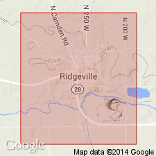
Huntington dolomite (here restricted) represents that part of Huntington formation of northern IN that contains Guelph fauna. Lower 43 ft of 70-ft section of Huntington, as exposed at Ridgeville, Randolph Co., IN, is relegated to underlying Cedarville formation. Huntington (restricted) and overlying New Corydon limestone are geographically extended into west-central OH.
Source: GNU records (USGS DDS-6; Reston GNULEX).

- Usage in publication:
-
- Huntington dolomite
- Modifications:
-
- Overview
- AAPG geologic province:
-
- Cincinnati arch
Summary:
Existence of Huntington as a formation has been questioned. Although dolomite identified as Huntington is exposed at numerous places throughout an area of more than 1,600 sq mi, contact of base of Huntington on an older formation has not been observed. Many exposures termed Huntington are reefs or beds associated with reefs. Some reefs formerly called Huntington are now considered to be Liston Creek or even Mississinewa in age.
Source: GNU records (USGS DDS-6; Reston GNULEX).

- Usage in publication:
-
- Huntington dolomite
- Modifications:
-
- Not used
- AAPG geologic province:
-
- Cincinnati arch
Summary:
Revision of Silurian stratigraphy of northern IN proposed, including abandonment of Huntington dolomite of Cumings and Shrock (1928).
Source: GNU records (USGS DDS-6; Reston GNULEX).
- Usage in publication:
-
- Huntington Dolomite†
- Modifications:
-
- Abandoned
- AAPG geologic province:
-
- Cincinnati arch
Summary:
Abandoned because of error in age, according to author. Strata has been reassigned to Salamonie Dolomite.
Source: GNU records (USGS DDS-6; Reston GNULEX).
For more information, please contact Nancy Stamm, Geologic Names Committee Secretary.
Asterisk (*) indicates published by U.S. Geological Survey authors.
"No current usage" (†) implies that a name has been abandoned or has fallen into disuse. Former usage and, if known, replacement name given in parentheses ( ).
Slash (/) indicates name conflicts with nomenclatural guidelines (CSN, 1933; ACSN, 1961, 1970; NACSN, 1983, 2005, 2021). May be explained within brackets ([ ]).