- Usage in publication:
-
- Huntersville chert
- Modifications:
-
- Named
- Dominant lithology:
-
- Chert
- AAPG geologic province:
-
- Appalachian basin
Summary:
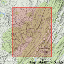
Named the Huntersville chert for Huntersville, Pocahontas Co., WV. Consists of yellow, gray, to dark, sandy chert. Thickness is from 30 to 65 feet and forms top division of Oriskany series. Overlies the Ridgeley sandstone and underlies the Marcellus shale. The Huntersville is of Early Devonian age.
Source: GNU records (USGS DDS-6; Reston GNULEX).
- Usage in publication:
-
- Huntersville chert
- Modifications:
-
- Redescribed
- Dominant lithology:
-
- Chert
- Shale
- Breccia
- AAPG geologic province:
-
- Appalachian basin
Summary:
The Huntersville chert consists of highly silicified black shale which contains many beds that have been brecciated and recemented with amorphous silica. At least on prominent glauconitic-bearing sandstone bed and numerous other sandy phosphatic or glauconitic layers exist. Also contains layers of brittle clay-shale. Thickness is 15 to 100 feet. Unit unconformably overlies the Ridgeley sandstone and underlies either the Needmore shale or, where the Needmore is absent, the Marcellus black shale. The Huntersville is of Middle Devonian age.
Source: GNU records (USGS DDS-6; Reston GNULEX).
- Usage in publication:
-
- Huntersville chert formation
- Modifications:
-
- Areal extent
- AAPG geologic province:
-
- Appalachian basin
Summary:
Geographically extended the Huntersville chert formation into PA, VA, and MD. Unit intertongues with Needmore shale to the northeast and the Onondaga limestone to the southwest. It is more than 200 feet thick in north-central WV. Only strata that is dominantly chert is assigned to the Huntersville. Unit includes the Bobs Ridge sandstone member at the top of the formation. The Huntersville chert is of Middle Devonian age.
Source: GNU records (USGS DDS-6; Reston GNULEX).
- Usage in publication:
-
- Huntersville Formation
- Modifications:
-
- Revised
- AAPG geologic province:
-
- Appalachian basin
Summary:
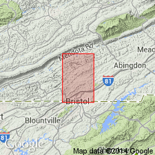
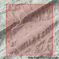
Revised the Huntersville to the Huntersville Formation. Consists of white, thin-bedded, iron-stained, blocky, fossiliferous chert, cherty, glauconitic sandstone, and greenish-gray siltstone. Unit is estimated to be between 10 and 60 feet thick. Base of formation is placed below chert or glauconitic sandstone above brown to maroon sandstone of the Clinch Formation, and top of formation is placed at base of black and varicolored shale of the Millboro Shale. Fossils include ostracods and brachiopods.
Source: GNU records (USGS DDS-6; Reston GNULEX).
- Usage in publication:
-
- Huntersville Member
- Modifications:
-
- Areal extent
- Revised
- AAPG geologic province:
-
- Appalachian basin
Summary:
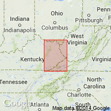
The Huntersville is considered the upper member of the Wildcat Valley Sandstone in eastern TN. Consists of 7.9 feet of fine-grained glauconitic sandstone with phosphatic nodules in upper part. This unit is identical to the Bobs Ridge Member of the Huntersville Chert Formation of Dennison (1961). The Huntersville overlies the Oriskany Member of the Wildcat Valley Sandstone and underlies the Chattanooga Shale. Unit is of Early Devonian age. Publication includes a measured section.
Source: GNU records (USGS DDS-6; Reston GNULEX).
- Usage in publication:
-
- Huntersville Formation
- Modifications:
-
- Areal extent
- Revised
- AAPG geologic province:
-
- Appalachian basin
Summary:
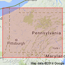
The Huntersville Formation is geographically extended to the subsurface of KY and is considered a formation within the Hunton Group. Unit overlies the Oriskany Sandstone and underlies the Ohio Shale. The Huntersville is of Middle Devonian age.
Source: GNU records (USGS DDS-6; Reston GNULEX).
- Usage in publication:
-
- Huntersville Formation
- Modifications:
-
- Areal extent
- AAPG geologic province:
-
- Appalachian basin
Summary:
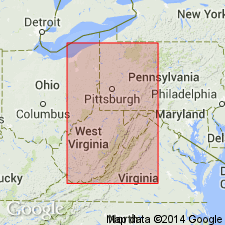
Geographically extended the Huntersville Formation to the subsurface of OH. Unit overlies the Keyser Limestone of the Helderberg Group and underlies the Columbus Limestone of the Onondaga Group. The Huntersville is of Early Devonian age.
Source: GNU records (USGS DDS-6; Reston GNULEX).
- Usage in publication:
-
- Huntersville Chert*
- Modifications:
-
- Overview
- AAPG geologic province:
-
- Appalachian basin
Summary:
Huntersville Chert and its Bobs Ridge Sandstone Member in its upper part occurs in WV, VA, KY, OH, PA, MD, and NY. It overlies the Oriskany Sandstone, underlies the Marcellus Shale, and it intertongues with the Onondaga Limestone and Needmore Shale. The age of the Huntersville is considered Early and Middle Devonian (Onesquethawan).
Source: GNU records (USGS DDS-6; Reston GNULEX).
For more information, please contact Nancy Stamm, Geologic Names Committee Secretary.
Asterisk (*) indicates published by U.S. Geological Survey authors.
"No current usage" (†) implies that a name has been abandoned or has fallen into disuse. Former usage and, if known, replacement name given in parentheses ( ).
Slash (/) indicates name conflicts with nomenclatural guidelines (CSN, 1933; ACSN, 1961, 1970; NACSN, 1983, 2005, 2021). May be explained within brackets ([ ]).

