The National Geologic Map Database is migrating to a new infrastructure. We apologize for any service disruptions during this process.
|
|---|


- Usage in publication:
-
- Hunter Canyon formation*
- Modifications:
-
- Named
- Dominant lithology:
-
- Sandstone
- Shale
- AAPG geologic province:
-
- Piceance basin
Summary:
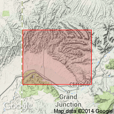
Named as the uppermost formation of the Mesaverde group on the Book Cliffs, Garfield and Mesa Cos, CO, Piceance basin. Type section measured in Hunter Canyon, T8S, R100W, Mesa Co, where formation is 1428+/-ft thick. Is equivalent to undifferentiated Mesaverde of Grand Mesa area, and to upper part of Farrer member of Price River formation and all or part of Tuscher formation to west. Consists of gray to buff, medium- to coarse-grained, massive cliff-forming sandstone and soft gray sandy shale. Some of the sandstone beds are cross-bedded; some are thinly laminated. Some of the strata are channeled. The massive sandstone beds are 10 to 40 ft thick. Many layers contain small spherical ferruginous concretions, of which a few are as large as 4 inches. Mud pellets and lumps flattened parallel to bedding occur in basal parts of many beds. Weathers to pedestal and turret features. Some beds are carbonaceous. Coal beds found at a few localities. Is 375 ft thick in west part of field; thickens east. Deposited in streams, on floodplains, in lakes and swamps. Overlies Mount Garfield formation (new) of Mesaverde group. Overlain by Wasatch formation. Geologic map, stratigraphic table. Of Late Cretaceous age.
Source: GNU records (USGS DDS-6; Denver GNULEX).
- Usage in publication:
-
- Hunter Canyon formation
- Modifications:
-
- Not used
Summary:
Terms "Mt. Garfield and Hunter Canyon formations" not used. Author applies the name Neslen facies (formerly Neslen member of Price River) to all the coal-bearing rocks of the Price River formation and the name Farrer facies (formerly Farrer member of Price River) to all the non-coal-bearing rocks of the Price River. Term Price River used along Book Cliffs from Castlegate area in Carbon Co, UT in the Uinta basin, across Emery and Grand Cos, UT in the Paradox basin, to Cameo on the Colorado River, Mesa Co, CO in the Piceance basin. From Thompsons, UT near the CO border, Price River is divided into (ascending): Castlegate (formerly Castlegate sandstone member), Sego (formerly Sego sandstone member), Corcoran (new), Cozzette (new), and Cameo (new) members. West of Thompsons, Price River divided into (ascending): Castlegate member and the overlying shale, sandy shale, and lenses of sandstone.
Source: GNU records (USGS DDS-6; Denver GNULEX).
- Usage in publication:
-
- Hunter Canyon Formation*
- Modifications:
-
- Revised
- AAPG geologic province:
-
- Piceance basin
Summary:
Ohio Creek, formerly thought to be a Paleocene unit that overlies the Mesaverde, is reduced in stratigraphic rank as a member of Mesaverde Formation near Ohio Creek, Gunnison Co, CO on southeast side of Piceance Creek basin, and to a member of Hunter Canyon Formation of Mesaverde Group near Hunter Canyon, Ts8 and 9S, R100W, Mesa Co, CO on southwest side of Piceance Creek basin. [Piceance Creek basin is part of the larger Piceance structural basin]. Ohio Creek ranges from Campanian to Maestrichtian or Late Cretaceous age depending on locality and is separated from overlying Wasatch Formation by a major regional unconformity. The member is a distinctive white (kaolinitic) sparsely conglomeratic sandstone.
Source: GNU records (USGS DDS-6; Denver GNULEX).
For more information, please contact Nancy Stamm, Geologic Names Committee Secretary.
Asterisk (*) indicates published by U.S. Geological Survey authors.
"No current usage" (†) implies that a name has been abandoned or has fallen into disuse. Former usage and, if known, replacement name given in parentheses ( ).
Slash (/) indicates name conflicts with nomenclatural guidelines (CSN, 1933; ACSN, 1961, 1970; NACSN, 1983, 2005, 2021). May be explained within brackets ([ ]).