

- Usage in publication:
-
- Hunt sandstone
- Modifications:
-
- Original reference
- Dominant lithology:
-
- Sandstone
- AAPG geologic province:
-
- Appalachian basin
Summary:
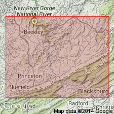
Pg. 293, 317. Hunt sandstone. Green massive or shaly sandstone, 10 to 20 feet thick, lying a few feet below Hunt coal ("the uppermost coal in Bluestone group" and exposed just west of Hunt School, Mercer County), and overlying Hunt shale. All members of Bluestone group [Bluestone formation], and all exposed in Stony Gap section, Mercer Co., on north side of Big Ridge, about 0.75 mi south of Belcher School, where the sandstone is 15 feet thick. Age is Mississippian.
[The Bluestone group is a term used by some geologists to include same rocks as Bluestone formation of USGS reports (US geologic names lexicon, USGS Bull. 896, p. 222).]
Source: US geologic names lexicon (USGS Bull. 896, p. 996).
- Usage in publication:
-
- Hunt shale
- Modifications:
-
- Original reference
- Dominant lithology:
-
- Shale
- AAPG geologic province:
-
- Appalachian basin
Summary:
Pg. 293, 317. Hunt shale. Red and variegated, 35 feet thick. Underlies Hunt sandstone and overlies Bratton sandstone. All members of Bluestone group [Bluestone formation], and all exposed in Stony Gap section, Mercer Co., on north side of Big Ridge, about 0.75 mi south of Belcher School. Age is Mississippian.
[The Bluestone group is a term used by some geologists to include same rocks as Bluestone formation of USGS reports (US geologic names lexicon, USGS Bull. 896, p. 222).]
Source: US geologic names lexicon (USGS Bull. 896, p. 997).
- Usage in publication:
-
- Hunt member
- Modifications:
-
- Original reference
- Dominant lithology:
-
- Shale
- Sandstone
- Coal
- AAPG geologic province:
-
- Appalachian basin
Summary:
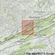
Pg. 185-186, pl. 15. Hunt member of Bluestone formation. Reger (1926, p. 293, 317) subdivided the 50 feet of the Bluestone into 3 units (ascending): Hunt shale, Hunt sandstone, and Hunt coal. These three units here considered the Hunt member of the Bluestone. [All units exposed in Stony Gap section, Mercer Co., on north side of Big Ridge, about 0.75 mi south of Belcher School.] In Burkes Garden quadrangle, member is 50 to 74 feet thick and consists of maroon-drab, apple-green, and reddish-buff shales; the redbeds are overlain by 12-foot zone of black carbonaceous shale, gray underclay, and coal. Underlies Bent Mountain member (new); overlies Bratton sandstone member. Relations indicate Hunt member is in trough of overturned syncline. Age is Late Mississippian (Chesterian).
Type locality: near Hunt School, Mercer Co., WV.
Reference cited: Reger, D.B., 1926, West Virginia Geol. Survey Rpt. Mercer, Monroe, and Summers Counties.
Source: US geologic names lexicon (USGS Bull. 1200, p. 1839).
- Usage in publication:
-
- Hunt beds
- Modifications:
-
- Overview
- AAPG geologic province:
-
- Appalachian basin
Summary:
Chart 5 (columns 97, 98). Correlation chart shows Hunt beds in Bluestone group or formation.
Source: US geologic names lexicon (USGS Bull. 1200, p. 1839).
For more information, please contact Nancy Stamm, Geologic Names Committee Secretary.
Asterisk (*) indicates published by U.S. Geological Survey authors.
"No current usage" (†) implies that a name has been abandoned or has fallen into disuse. Former usage and, if known, replacement name given in parentheses ( ).
Slash (/) indicates name conflicts with nomenclatural guidelines (CSN, 1933; ACSN, 1961, 1970; NACSN, 1983, 2005, 2021). May be explained within brackets ([ ]).