

- Usage in publication:
-
- Hunt Fork Shale*
- Modifications:
-
- Named
- Biostratigraphic dating
- Dominant lithology:
-
- Shale
- Slate
- Sandstone
- Siltstone
- AAPG geologic province:
-
- Alaska Northern region
Summary:
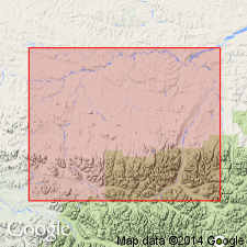
Type locality designated as exposures 25 miles east of Killik River at 68 deg 18'N, 153 deg 20'W along Fire Creek, east-flowing tributary of Okokmilaga River, central Brooks Range, AK. Composed of predominantly shale, locally metamorphosed to slate with minor amounts of interbedded hard sandstone and siltstone. Shale is gray brown to dark gray and weathers a mottled dark yellow red. Slate is dark gray green to black and weathers dark yellow red. Siltstone is dark gray green. Not entirely exposed at any one locality. Thickness is 952 m at type. Overlies unnamed Middle Devonian metasedimentary rocks. Underlies Kanayut Conglomerate. Area of occurrence includes upper Killik River at confluence with Easter Creek, 2 miles north of Etivluk Lake, Nigu Valley, and upper Killik Valley. Age is Late Devonian based on biostratigraphic dating of marine brachiopods, pelecypods, gastropods, and fish teeth found in upper part of formation.
Source: GNU records (USGS DDS-6; Menlo GNULEX).

- Usage in publication:
-
- Hunt Fork Shale*
- Modifications:
-
- Revised
- Areal extent
- AAPG geologic province:
-
- Alaska Northern region
Summary:
Hunt Fork Shale assigned to Endicott Group (new) as lowest of five formations. Geographically extended into DeLong, Baird, and Philip Smith Mountains. Overlies concordantly Skajit Limestone (Baird Group) in DeLong Mountains, and an unnamed limestone, siltstone, conglomerate and graywacke that locally overlie Skajit Limestone. Corals and brachiopods of early Late Devonian (Frasnian) age occur in upper part of formation in central and eastern Brooks Range; CYRTOSPIRIFER sp is most common. A CYRTOSPIRIFER specimen from sandy beds in southern DeLong Mountains may be late Late Devonian (Famennian) in age. Assigned Late Devonian age.
Source: GNU records (USGS DDS-6; Menlo GNULEX).
For more information, please contact Nancy Stamm, Geologic Names Committee Secretary.
Asterisk (*) indicates published by U.S. Geological Survey authors.
"No current usage" (†) implies that a name has been abandoned or has fallen into disuse. Former usage and, if known, replacement name given in parentheses ( ).
Slash (/) indicates name conflicts with nomenclatural guidelines (CSN, 1933; ACSN, 1961, 1970; NACSN, 1983, 2005, 2021). May be explained within brackets ([ ]).