The National Geologic Map Database is migrating to a new infrastructure. We apologize for any service disruptions during this process.
|
|---|


- Usage in publication:
-
- Hungry Run sandstone member*
- Modifications:
-
- Original reference
- Dominant lithology:
-
- Sandstone
- Siltstone
- AAPG geologic province:
-
- Appalachian basin
Summary:
Pg. 1347, 1351, 1364-1366; J.F. Pepper, Wallace de Witt, Jr., and D.F. Demarest, 1954, USGS Prof. Paper 259, p. 18 (fig. 9), 43-45. Hungry Run sandstone member of Orangeville shale. Name proposed for massive iron-stained coarse-grained sandstone and underlying massive siltstone. Sandstone is cross-bedded, conglomeratic in upper part, and includes zone of clay galls and lens of petroliferous sandstone. Lenses of flattened discoidal pebbles occur in conglomerate. Thickness 12 feet. Overlying beds not exposed at type locality; in some Crawford County localities, underlies dark silty part of Orangeville shale. Overlies either siltstones of Corry sandstone or Cussewago sandstone. Age is Early Mississippian.
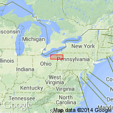
Type locality: small quarry on a headwater of Hungry Run, 1 mi west of southeastern corner of Union Twp., Erie Co., northwestern PA. Also exposed in Crawford Co.
Source: US geologic names lexicon (USGS Bull. 1200, p. 1838-1839).
For more information, please contact Nancy Stamm, Geologic Names Committee Secretary.
Asterisk (*) indicates published by U.S. Geological Survey authors.
"No current usage" (†) implies that a name has been abandoned or has fallen into disuse. Former usage and, if known, replacement name given in parentheses ( ).
Slash (/) indicates name conflicts with nomenclatural guidelines (CSN, 1933; ACSN, 1961, 1970; NACSN, 1983, 2005, 2021). May be explained within brackets ([ ]).