The National Geologic Map Database is migrating to a new infrastructure. We apologize for any service disruptions during this process.
|
|---|


- Usage in publication:
-
- Hungerford formation
- Modifications:
-
- Original reference
- Dominant lithology:
-
- Slate
- Dolomite
- Limestone
- AAPG geologic province:
-
- New England province
Summary:
Pg. 1045, 1047-1049, 1055. Hungerford formation. Chiefly blue-black to gray well-banded slates with local lentils of sandy dolomites also many white limestone bioherms. Hungerford beds formerly considered same as Highgate formation. Near Highgate Center, the name, Russell slate, is abandoned and beds are named Hungerford. Maximum thickness about 700 feet. Disconformably underlies Rockledge breccia (new) or Georgia formation; overlies Mill River breccia, St. Albans slate, or Parker slate. [Age is Middle Cambrian.]
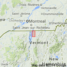
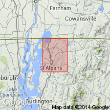
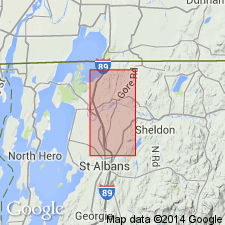
Type area: where Hungerford Brook crosses Highgate Road, about 1.25 mi south of Highgate, Franklin Co., northwestern VT. Thick sections also found west of Georgia Center and in Milton Twp.
Source: US geologic names lexicon (USGS Bull. 1200, p. 1838).
- Usage in publication:
-
- Hungerford formation
- Modifications:
-
- Revised
- AAPG geologic province:
-
- New England province
Howell, B.F., 1939, [Title unknown] [abs.]: Geological Society of America Bulletin, v. 50, no. 12, pt. 2, p. 1964.
Summary:
Hungerford formation. Stratigraphically restricted. Lowermost fossiliferous beds named Skeels Corner formation; the sandstone disconformably overlying them named Saxe Brooke formation. [Age is Middle Cambrian.]
Source: US geologic names lexicon (USGS Bull. 1200, p. 1838).
- Usage in publication:
-
- Hungerford slate
- Modifications:
-
- Revised
- Redescribed
- AAPG geologic province:
-
- New England province
Summary:
Pg. 523 (table 1), 532 (fig. 5), 547-548, pl. 1. Hungerford slate of Woods Corner group. Schuchert (1937) misinterpreted structures at type locality and believed that Hungerford slate lay below Rockledge conglomerate. Detailed mapping has proved that Rockledge plunges northward under slate at Hungerford Brook and that Hungerford slate is younger than Rockledge conglomerate. Because of this misinterpretation of stratigraphic position of Hungerford, Schuchert and subsequent workers have referred to Hungerford slate all beds now designated as Skeels Corners slate. Ruedemann (1947) referred to this formation as Russell slate. Consists almost entirely of black slate, commonly in beds 2 to 10 mm thick, alternating with beds of fine-grained white sandstone, commonly less than 3 mm thick. Thickness about 400 feet at type locality; about 200 feet at international boundary. Underlies Gorge formation. Gradationally overlies Rockledge conglomerate; overlies Skeels Corners slate where Rockledge is absent. Is uppermost formation in Wood Corners group (new). Age is Middle Cambrian.
Source: US geologic names lexicon (USGS Bull. 1200, p. 1838).
- Usage in publication:
-
- Hungerford slate member
- Modifications:
-
- Revised
- Age modified
- AAPG geologic province:
-
- New England province
Summary:
Hungerford slate member of Sweetsburg formation. Black slate. Is uppermost member of Sweetburg formation. Underlies Highgate formation. Overlies Rockledge conglomerate member of Sweetsburg. Age is Late Cambrian.
Mapped in St. Albans area, Franklin Co., northwestern VT.
Source: Publication.
- Usage in publication:
-
- Hungerford†
- Modifications:
-
- Abandoned
- AAPG geologic province:
-
- New England province
Summary:
The Hungerford Slate is abandoned in the St. Albans and Highgate Center quads. Strata previously called Hungerford is reassigned to the Skeels Corners Slate.
Source: GNU records (USGS DDS-6; Reston GNULEX).
For more information, please contact Nancy Stamm, Geologic Names Committee Secretary.
Asterisk (*) indicates published by U.S. Geological Survey authors.
"No current usage" (†) implies that a name has been abandoned or has fallen into disuse. Former usage and, if known, replacement name given in parentheses ( ).
Slash (/) indicates name conflicts with nomenclatural guidelines (CSN, 1933; ACSN, 1961, 1970; NACSN, 1983, 2005, 2021). May be explained within brackets ([ ]).