

- Usage in publication:
-
- Hueco formation
- Modifications:
-
- Original reference
- Dominant lithology:
-
- Limestone
- Shale
- Sandstone
- AAPG geologic province:
-
- Orogrande basin
- Permian basin
Summary:
Pg. 32-38, geol. map. Hueco formation. Mainly massive gray fossiliferous nonmagnesium limestone, locally including beds of shale and sandstone. Thickness at least 5,000 feet. Represents the Pennsylvanian in Diablo Plateau, Franklin, Cornudas, Diablo, Finlay, and Hueco Mountains. Fossils assigned to Pennsylvanian by G.H. Girty. Relations to Delaware Mountain formation (Permian) not determined, but supposed to be older. Age is Pennsylvanian.
Named from exposures in Hueco Mountains, El Paso Co. [now in Hudspeth Co.], western TX.
Source: US geologic names lexicon (USGS Bull. 896, p. 991-992).
- Usage in publication:
-
- Hueco limestone*
- Modifications:
-
- Revised
- Overview
- AAPG geologic province:
-
- Orogrande basin
- Permian basin
Summary:
Revised in El Paso quad, El Paso Co, TX, Orogrande basin where Hueco overlies Fusselman limestone (first used) and in Van Horn quad, Culberson Co, TX, Permian basin, where Hueco overlies Montoya limestone (first used); in both quads Hueco was deposited after great hiatus. Hueco outcrops in an area of several hundred square mi in trans-Pecos Texas; outcrops in Sierra Diablo, Finlay, Hueco, and Franklin Mountains. Thickness is more than 3000 ft in El Paso quad and more than 2500 ft in Van Horn quad. Fossil list. Pennsylvanian age.
Source: GNU records (USGS DDS-6; Denver GNULEX).
- Usage in publication:
-
- Hueco limestone*
- Modifications:
-
- Revised
- AAPG geologic province:
-
- Permian basin
Summary:
Hueco revised--with pronounced unconformity overlies (in places) the newly named pre-Cambrian? Millican formation (as well as other older rocks) in report area, Van Horn quadrangle, Hudspeth and Culberson Cos, TX in Permian basin. Basal conglomerate of Hueco overlies eroded surface of Millican at southern escarpment of the Sierra Diablo. In the hills 6 mi northwest of Van Horn, Hueco lies almost horizontally on Upper Cambrian? Van Horn sandstone; overlies Van Horn also at Threemile Mountain. At south end of Baylor Mountains the unconformity at base of Hueco is also plainly evident. The stratigraphic top of Hueco not exposed in the report area. In a number of localities on the Diablo Plateau an eroded surface of Hueco is directly overlain by Cretaceous strata, outlying remnants of which also lie on the Hueco north of the RR in the Carrizo Mountains. Hueco is Pennsylvanian in age. Geologic, structural, and topographic maps. Columnar section.
Source: GNU records (USGS DDS-6; Denver GNULEX).
- Usage in publication:
-
- Hueco formation
- Modifications:
-
- Revised
- AAPG geologic province:
-
- Orogrande basin
Summary:
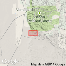
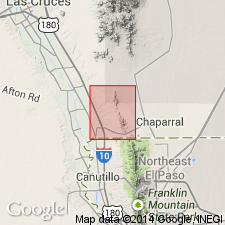
Hueco formation represents the Permian in the Franklin Mountains, and 650 ft are exposed in that locality. These sediments occur as outliers about 1/4 mi west of the Franklin Range and are separated from the exposed underlying Magdalena formation by alluvial deposits. [Magdalena is revised; divided into Bishop's Cap, Berino, and La Tuna members, all first used and areally extended into report area.] As a result, the contact between the Pennsylvanian Magdalena and the Permian Hueco not seen. In Silver City-Santa Rita district, Grant Co, NM in Basin-and-Range province the Permian is represented by Abo sandstone (thin film to 200 ft thick). In Oscura Mountains, Socorro Co, NM in Orogrande basin the Permian is represented by Abo sandstone below and Yeso and San Andres above. "There is a probability that most of the Hueco limestone of the Hueco Mountains is Permian in age and that only a small part of the Hueco, as originally defined, is Pennsylvanian. The correct name for the Pennsylvanian, in this district [Franklin Mountains], therefore, would seem to be Magdalena, since this name applies to the Pennsylvanian sediments in the neighboring vicinities [in NM]." Latter statement constitutes a revision of Hueco in Franklin Mountains. Permian age. Stratigraphic chart.
Source: GNU records (USGS DDS-6; Denver GNULEX).
- Usage in publication:
-
- Hueco limestone*
- Modifications:
-
- Revised
- AAPG geologic province:
-
- Orogrande basin
Summary:
In the Orogrande basin of south-central NM, composed in almost equal proportions of olive-gray to medium-gray, fine-grained limestone in beds 1 in to 1 ft thick that has poorly preserved gastropod and ostracod fossils and gray, calcareous shale. Brown, thin-bedded, cross-laminated sandstone and siltstone present as thin units. Is 350 to 600 ft thick. Underlain by Danley Ranch tongue (new) of Abo sandstone; grades laterally into and conformably underlies Lee Ranch tongue (new) of Abo. Is a marine unit, probably Wolfcamp except uppermost part and laterally equivalent to Lee Ranch which is early Leonard, Early Permian age.
Source: GNU records (USGS DDS-6; Denver GNULEX).
- Usage in publication:
-
- Hueco Formation
- Modifications:
-
- Contact revised
- AAPG geologic province:
-
- Permian basin
Summary:
Upper contact revised in that Hueco unconformably underlies the newly named Wilkie Ranch Formation in the Finlay Mountains of Hudspeth Co, TX in the Permian basin. Rocks assigned to the Wilkie Ranch were called "Leonard series (undivided)" by Albritton, Smith (1965) and were informally designated "Wilkie Ranch formation" by Cys in 1975.
Source: GNU records (USGS DDS-6; Denver GNULEX).
- Usage in publication:
-
- Hueco Limestone, Formation
- Modifications:
-
- Revised
- AAPG geologic province:
-
- Orogrande basin
Summary:
Revised in that unit conformably overlies Panther Seep Formation which is extended to northern part of Franklin Mountains, southeast Dona Ana Co, NM, Orogrande basin. Panther Seep assigned to Magdalena Group. In map area, Hueco consists of lower member and part of middle member. Referred to as Hueco Formation on correlation of map units. Early Permian (Wolfcampian) age.
Source: GNU records (USGS DDS-6; Denver GNULEX).
For more information, please contact Nancy Stamm, Geologic Names Committee Secretary.
Asterisk (*) indicates published by U.S. Geological Survey authors.
"No current usage" (†) implies that a name has been abandoned or has fallen into disuse. Former usage and, if known, replacement name given in parentheses ( ).
Slash (/) indicates name conflicts with nomenclatural guidelines (CSN, 1933; ACSN, 1961, 1970; NACSN, 1983, 2005, 2021). May be explained within brackets ([ ]).