

- Usage in publication:
-
- Hudspeth Cutoff Sandstone
- Modifications:
-
- Named
- Dominant lithology:
-
- Sandstone
- Siltstone
- AAPG geologic province:
-
- Great Basin province
Summary:
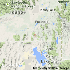
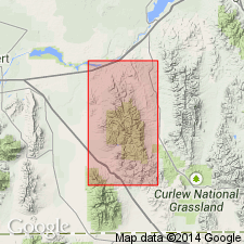
Named for a wagon road which enters Sublett Range, from the east in sec 20, T13S, R31E, Oneida Co, ID in Great Basin province. Type section is along north wall from NW1/4 sec 17 to center sec 19, T13S, R31E. Approximate thickness of formation is 3,500 ft measured in one fault block. Is predominately tan to gray quartzose sandstone and siltstone, some of which is calcareous. Some interbedded quartzite. Dark chert present as stringers and nodules in some sandstone beds; chert is more common in lower part of formation. Sandy fossiliferous, cherty, dolostone beds intercalated with calcareous quartzite occur near top of formation. Bedding is massive to thin. Overlies Indian Fork Member of Wells Formation; underlies an unnamed massive cherty dolostone. No diagnostic fossils found. Is of Early Permian, Wolfcampian? age. Type section measured. Graphic sections.
Source: GNU records (USGS DDS-6; Denver GNULEX).
- Usage in publication:
-
- Hudspeth Cutoff Formation
- Modifications:
-
- Revised
- Redescribed
- AAPG geologic province:
-
- Great Basin province
Summary:
Name changed from Hudspeth Cutoff Sandstone to Hudspeth Cutoff Formation and assigned as the upper formation of Oquirrh Group in Cassia and Oneida Cos, ID, Great Basin province. Overlies Trail Canyon Formation, newly assigned to the Oquirrh; contact considered conformable. Underlies a fossiliferous post-Oquirrh unit of interbedded limestone, dolomite, sandstone and chert 800 m thick; this unit may be part of Park City Group, but is very different from the Phosphoria Formation. Former Hudspeth Cutoff included a lower limestone and chert that are part of the Trail Canyon and an upper interbedded sandstone and dolomite that belong to the post-Oquirrh unit. Consists of about 700 m of mostly noncalcareous, partly quartzitic sandstone and minor sandy limestone and chert. Generally forms smooth slopes with ledges. Fusulinids identified suggest post-early Wolfcampian. Age of Wolfcampian and early Leonardian shown. Replaces former name Heydlauff Sandstone, a term abandoned. Nomenclature chart. Geologic map. Columnar section.
Source: GNU records (USGS DDS-6; Denver GNULEX).
For more information, please contact Nancy Stamm, Geologic Names Committee Secretary.
Asterisk (*) indicates published by U.S. Geological Survey authors.
"No current usage" (†) implies that a name has been abandoned or has fallen into disuse. Former usage and, if known, replacement name given in parentheses ( ).
Slash (/) indicates name conflicts with nomenclatural guidelines (CSN, 1933; ACSN, 1961, 1970; NACSN, 1983, 2005, 2021). May be explained within brackets ([ ]).