- Usage in publication:
-
- Huber Formation
- Modifications:
-
- Named
- Dominant lithology:
-
- Sand
- AAPG geologic province:
-
- South GA-North FL sedimentary province
Summary:
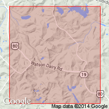
Named the Huber Formation for Huber Post Office, Twiggs Co., GA. Consists of white to cream, buff, gray, medium- to coarse-grained, cross-bedded, fossiliferous sand with tubular and ball form kaolin beds. Thickness ranges from less than 1 to 28.7 m and averages 10.2 m. Unit unconformably overlies undifferentiated Cretaceous strata and unconformably underlies the Clinchfield Sand, Tivola Limestone, or Barnwell Formation. The Huber is of Paleocene and Eocene age.
Source: GNU records (USGS DDS-6; Reston GNULEX).
- Usage in publication:
-
- Huber Formation
- Modifications:
-
- Revised
- AAPG geologic province:
-
- South Georgia sedimentary province
Summary:
The Huber of this report includes essentially the same strata as Buie (1978) included in his original definition. However, the Huber here is assigned to the Oconee Group (new) and is subdivided into the Marion Member and informal Jeffersonville member. The continued recognition of the Huber is only tentative. The Marion is clearly part of the Oconee Group, an apron sand that includes kaolin and kaolinitic sands of fluvial origin. The Jeffersonville, though, may be a part of the Fort Valley Group, which includes similar lithologies of marine origin. If this proves to be the case, then the Huber will be abandoned. The Jeffersonville will remain informal until a determination is made. The Huber as identified in SC does not correlate in lithology or age with the type Huber. The unit is restricted in outcrop and subcrop, to the Fall Line Hills district of central and eastern GA, the northern part of the Louisville Plateau District of eastern GA. It does not occur west of the Ocmulgee River. Disconformably overlies the Gaillard Formation in most places in GA. Disconformably underlies the Barnwell Group. Age of the Huber at the type section is early Paleocene (Midwayan), though middle Eocene (Claibornian) deposits were once exposed there.
Source: GNU records (USGS DDS-6; Reston GNULEX).
- Usage in publication:
-
- Huber Formation
- Modifications:
-
- Overview
- AAPG geologic province:
-
- Atlantic Coast basin
Summary:
Authors include the Huber, Congaree, Warley Hill and McBean Formations in the Orangeburg Group. The Huber and the Congaree are age equivalent facies and correlate with the Tallahatta Formation of AL. Huber originally included beds of both Paleocene and Eocene ages, but here designates updip sediments in a single depositional sequence of early middle Eocene age. Paleocene strata are not included here as part of the unit. The Huber is characterized by commercial kaolin deposits and cross-bedded, poorly sorted, coarse sands with kaolin balls. Transition to the downdip Congaree Formation is gradational. Boundary between the two units is drawn between Jackson, near the Savannah River, and Swansea, located on the interfluve just southwest of the Congaree River. Huber is up to 27 m thick in Horse Creek Valley near Bath and Langley in Aiken Co.
Source: GNU records (USGS DDS-6; Reston GNULEX).
- Usage in publication:
-
- "Huber"
- Modifications:
-
- Not used
- AAPG geologic province:
-
- Atlantic Coast basin
Summary:
Term "Huber" has been used in the study area by various workers. It probably consists of Paleocene, early Eocene, and middle Eocene sediments deposited near the Fall Line. Post Cretaceous-pre-Jacksonian deposits updip from the Savannah River Site are referred to as undifferentiated lower Tertiary in this report.
Source: GNU records (USGS DDS-6; Reston GNULEX).
- Usage in publication:
-
- Huber Formation
- Modifications:
-
- Age modified
- AAPG geologic province:
-
- Atlantic Coast basin
Summary:
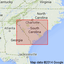
Early Eocene dates have been obtained from most of the stratigraphic interval formerly assigned to the early middle Eocene at the Savannah River Site. (Unit E-1 of Prowell and others (1985) composes most of the lower Eocene section at the Site.) Authors' data indicate that lower Eocene strata are 40 to 50 ft thick near the northern boundary of the Site, and probably continue updip into Aiken Co. Thus, authors state that it is likely that part of the Huber Formation as mapped by Nystrom and Willoughby (1982) and Nystrom and others (1986; 1989) is of early Eocene age.
Source: GNU records (USGS DDS-6; Reston GNULEX).
- Usage in publication:
-
- Huber Formation*
- Modifications:
-
- Mapped 1:100k
- Dominant lithology:
-
- Sand
- Kaolin
- AAPG geologic province:
-
- Atlantic Coast basin
- South Georgia sedimentary province
Summary:
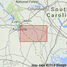
Pg. 5, 8-9, 14, 21, geol. map. Huber Formation of Buie (1978, 1980). Fine to very coarse, poorly sorted, angular quartz sand in a matrix of white kaolin. Restricted marine delta-plain deposits. Previously included in Tuscaloosa Formation by Cooke (USGS Bull. 867, 1936). Mapped with Congaree Formation, undivided. Congaree believed to be a facies of Huber; mineralogy is identical, but sorting and bed forms change with respect to position on the delta. Best exposures in commercial kaolin strip mines. Formations can interfinger, but marine Congaree is usually found below the prograding fluvial Huber. Underlies McBean Formation. Age is lower middle Eocene (Lutetian; Claibornian), based on fossils (dinoflagellates and pollen identified by L.E. Edwards and N.O. Frederiksen, USGS, written commun., 1982-1985).
Best exposure in Dixie Clay Company McNamee No. 2 strip mine, about 1.5 mi southeast of Bath, SC.
Source: Publication.
- Usage in publication:
-
- "Huber Formation"
- Modifications:
-
- Not used
- AAPG geologic province:
-
- Atlantic Coast basin
Summary:
The Huber, according to authors, does not appear to be a valid stratigraphic concept on the formation level. It has been defined differently in GA and SC and probably includes several depositional sequences of Paleocene and Eocene age, though Nystrom and others (1986: Carolina Geological Society Field Trip Guidebook) restricted the term in the updip Coastal Plain of southwestern SC to a single depositional sequence of middle Eocene age. Term used here instead of Huber is "undifferentiated lower Tertiary."
Source: GNU records (USGS DDS-6; Reston GNULEX).
For more information, please contact Nancy Stamm, Geologic Names Committee Secretary.
Asterisk (*) indicates published by U.S. Geological Survey authors.
"No current usage" (†) implies that a name has been abandoned or has fallen into disuse. Former usage and, if known, replacement name given in parentheses ( ).
Slash (/) indicates name conflicts with nomenclatural guidelines (CSN, 1933; ACSN, 1961, 1970; NACSN, 1983, 2005, 2021). May be explained within brackets ([ ]).

