The National Geologic Map Database is migrating to a new infrastructure. We apologize for any service disruptions during this process.
|
|---|


- Usage in publication:
-
- Houchin Creek Coal Member
- Modifications:
-
- Overview
- AAPG geologic province:
-
- Illinois basin
Summary:
First use of name credited to Fuller and Ashley (1902: USGS Geol. Atlas, Folio 84). Formal designation and type section credited to Wier (1961: IN G.S. Mem. Rept. C-30; and 1965: IN G.S. Mem. Rept C-131 [neither one available]). Described here as a bright-banded coal that ranges from 0.2 to 3.6 ft in thickness. Outcrops present in the area extending from west of Newport, Vermillion Co., to east of Boonville, Warrick Co. Coal is underlain by a thin underclay and Survant Coal Member of Linton Formation. Overlain by a black fissile shale and the Stendal Limestone Member of Petersburg Formation.
Source: GNU records (USGS DDS-6; Reston GNULEX).
- Usage in publication:
-
- Houchin Creek Coal Member/coal bed
- Modifications:
-
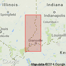
- Areal extent
- AAPG geologic province:
-
- Illinois basin
Summary:
Houchin Creek Coal Member of Carbondale Formation used in IL to replace Summum (No. 4) Coal Member. Occurs 75 to 120 ft above Colchester Coal Member. Unit also referred to as Ruff coal bed in western KY. In IL, underlies the Excello Shale Member, also of the Carbondale.
Source: GNU records (USGS DDS-6; Reston GNULEX).

- Usage in publication:
-
- Houchin Creek Coal Member
- Modifications:
-
- Overview
- Reference
- AAPG geologic province:
-
- Illinois basin
Summary:
Indiana Geological Survey drillhole SDH 306 is herein designated the reference core for the Houchin Creek Coal Member of the Petersburg Formation; the Survant Coal, Velpen Limestone, Mecca Quarry Shale, and Colchester Coal Members of the Linton Formation; the Seelyville Coal Member of the Staunton Formation; and the boundary between the Petersburg and Linton Formations. SDH 306 is located near the type section of the Survant Coal Member, in SW1/4 NE1/4 sec. 2, T2S, R7W, Pike Co., southern IN. Houchin Creek Coal Member underlies the Stendal Limestone Member and is described as a bright banded coal, with fusain imprints on some bedding planes. Thickness in the core is 0.4 ft.
Source: GNU records (USGS DDS-6; Reston GNULEX).
For more information, please contact Nancy Stamm, Geologic Names Committee Secretary.
Asterisk (*) indicates published by U.S. Geological Survey authors.
"No current usage" (†) implies that a name has been abandoned or has fallen into disuse. Former usage and, if known, replacement name given in parentheses ( ).
Slash (/) indicates name conflicts with nomenclatural guidelines (CSN, 1933; ACSN, 1961, 1970; NACSN, 1983, 2005, 2021). May be explained within brackets ([ ]).