

- Usage in publication:
-
- Hosta sandstone member*
- Modifications:
-
- Original reference
- Dominant lithology:
-
- Sandstone
- AAPG geologic province:
-
- San Juan basin
Summary:
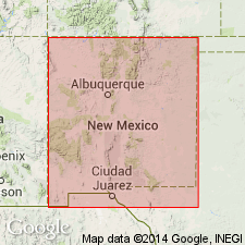
Hosta sandstone member of Mesaverde formation. The sandstone that appears in midst of Gibson coal member northwest of Walker's store thickens rapidly to north and east, and within 10 miles to northeast it is 250+/- feet thick. To this unit writer is here applying the name Hosta sandstone member, because it caps the prominent Hosta Butte. It also forms the major cliff or rim and the top of the northward-sloping ridge behind it. To north the sandstone is split into 2 distinct tongues by a wedge of marine shale that forms Satan tongue of Mancos shale. Age is Late Cretaceous. The upper sandstone of Hosta member is of earliest Montana age and the underlying rocks are of Colorado age.
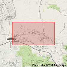
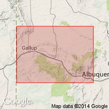
Recognized in Gallup region, northwestern NM.
Source: US geologic names lexicon (USGS Bull. 896, p. 984).
- Usage in publication:
-
- Hosta sandstone tongue
- Modifications:
-
- Revised
- AAPG geologic province:
-
- San Juan basin
Summary:
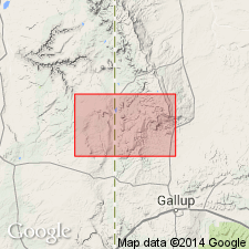
Hosta sandstone member of Upper Cretaceous Mesaverde formation reassigned as Hosta sandstone tongue of Point Lookout sandstone of Mesaverde group in Tohatchi quad, McKinley Co, NM in San Juan basin. Is present between area east of Gallup to Mount Taylor. Is a homogeneous-colored, pale-orange to yellowish-gray, massive, faintly cross-bedded, medium- to coarse-grained arkosic sandstone with a clay matrix. Cementation is fair to good. Overlies Crevasse Canyon formation (named in this report); is older than Menefee formation.
Source: GNU records (USGS DDS-6; Denver GNULEX).
- Usage in publication:
-
- Hosta tongue*
- Modifications:
-
- Revised
- AAPG geologic province:
-
- San Juan basin
Summary:
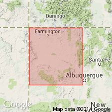
Hosta sandstone member of Point Lookout sandstone changed to Hosta tongue of Point Lookout sandstone of Mesaverde group. Term Mesaverde raised to group rank throughout San Juan basin of southwest CO and northwest NM. Is also stratigraphically restricted to what was only the lower part of Hosta in earlier reports. The restricted Hosta overlies Gibson coal member (restricted lower part of Gibson of earlier reports) and underlies Satan tongue of Mancos shale. Is the lowest unit of Mesaverde in the eastern San Juan basin. Simplified geologic map. Diagrammatic cross section. Of Late Cretaceous age.
Source: GNU records (USGS DDS-6; Denver GNULEX).
- Usage in publication:
-
- Hosta Tongue*
- Modifications:
-
- Biostratigraphic dating
- Mapped 1:500k
- Overview
- Dominant lithology:
-
- Sandstone
- AAPG geologic province:
-
- San Juan basin
Summary:
Is mapped as lower tongue of the Point Lookout Sandstone in vicinity of Mesa de los Lobos and Satan Pass, McKinley Co, and south of Toadlena, San Juan Co, NM (San Juan basin). The zonal index fossil CLIOSCAPHITES VERMIFORMIS is recorded (fig. 7) from the Hosta Tongue in the Tohachi area, northwest McKinley Co, NM. The zonal index is indicative of the third zone in the equivalents of the Smoky Hill Member of the Niobrara Formation in the Western Interior reference sequence of Cobban and Reeside (1952) [and is therein assigned as the basal zone of the Santonian Stage.] The Hosta Tongue is present for about 25 mi, south of Toadlena and in the Mesa de los Lobos areas where it is separated from the Point Lookout by the Satan Tongue of the Mancos Shale, which is 330 ft thick near Toadlena and which thins until it pinches out near Crevasse Canyon, south of the Chuska Mountains, and also near Dalton Pass, in the Mesa de los Lobos area. Where the Satan Tongue pinches out, the Hosta Tongue merges with the Point Lookout Sandstone, and the two cannot be distinguished. Hosta ranges in thickness from 0 to 120 ft; is mostly sandstone, thick bedded, grayish orange (10YR 7/4) to yellowish gray (5Y 8/1), fine grained, calcareous, and well sorted. Near Toadlena, the Hosta (possibly in combination with the Dalton Sandstone Member of the Crevasse Canyon Formation) contains interbedded gray shale, and about 3 mi southeast of Toadlena, the Hosta grades laterally into the upper part of the Mancos Shale. In the Mesa de los Lobos area, the Hosta merges with the overlying Point Lookout and forms prominent ledgy cliffs. The combined unit is as thick as 250 ft and is noticeably coarser grained than either the Point Lookout or the Hosta where the two can be distinguished.
Source: GNU records (USGS DDS-6; Denver GNULEX).
- Usage in publication:
-
- Hosta Tongue*
- Modifications:
-
- Areal extent
- AAPG geologic province:
-
- San Juan basin
Summary:
About 25 mi northeast of Gallup, NM near Coal Mine Canyon, Hosta Tongue of Point Lookout pinches out. South of Coal Mine Canyon, Gibson Coal Member of the Crevasse Canyon Formation and the Cleary Coal Member of the Menefee Formation cannot be separated. [The stratigraphic restriction by Beaumont and others (1956) of the Gibson to only the lower part of what Sears in 1925 assigned to the Gibson, and application of the name Cleary by Beaumont and others to the upper part of what Sears assigned to the Gibson has set up a formation contact--Crevasse Canyon-Menefee contact--that cannot be mapped according to these authors.]
Source: GNU records (USGS DDS-6; Denver GNULEX).
- Usage in publication:
-
- Hosta Tongue*
- Modifications:
-
- Areal extent
- AAPG geologic province:
-
- San Juan basin
Summary:
Hosta Tongue of the Point Lookout Sandstone is limited in distribution in the southern part of the San Juan basin. In the cliffs south of Crownpoint, McKinley Co, NM, the Hosta is about 90 ft thick and it forms the middle cliff beneath the slope-forming Satan Tongue. This thin remnant of the Hosta pinches out within marine shale less than 1 mi north. Where it has pinched out, the marine Satan Tongue of the Mancos Shale rests on coastal plain deposits of the Gibson Member of the Crevasse Canyon Formation. South of Satan Pass in McKinley Co, the Satan pinches out and the marine body of the Point Lookout and the Hosta merge. The sandstone at Hosta Butte can only be assigned to the Point Lookout; the Hosta is not mappable there. The landward extent of the Hosta is only a few mi south of Crownpoint. The Hosta and Point Lookout are merged also in the Church Rock Mining District.
Source: GNU records (USGS DDS-6; Denver GNULEX).
For more information, please contact Nancy Stamm, Geologic Names Committee Secretary.
Asterisk (*) indicates published by U.S. Geological Survey authors.
"No current usage" (†) implies that a name has been abandoned or has fallen into disuse. Former usage and, if known, replacement name given in parentheses ( ).
Slash (/) indicates name conflicts with nomenclatural guidelines (CSN, 1933; ACSN, 1961, 1970; NACSN, 1983, 2005, 2021). May be explained within brackets ([ ]).