The National Geologic Map Database is migrating to a new infrastructure. We apologize for any service disruptions during this process.
|
|---|


- Usage in publication:
-
- Hortonville slate*
- Modifications:
-
- Named
- Dominant lithology:
-
- Slate
- Phyllite
- AAPG geologic province:
-
- New England province
Summary:
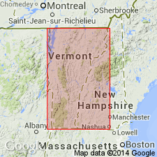
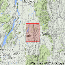
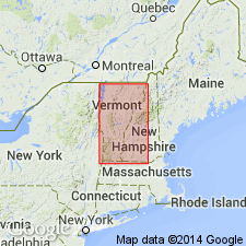
Named the Hortonville slate for Hortonville, Rutland Co., southwestern VT. Consists of dark or black slate with portions sufficiently altered to be called phyllite. Also contains a few small seams of siliceous material giving a local banded appearance. As a rule, the bedding is obscured by the cleavage. Though unit is nonfossiliferous, it is correlated with the Snake Hill formation of NY. Overlies the Hyde Manor limestone. The Hortonville is of Middle Ordovician (early Trentonian) age.
Source: GNU records (USGS DDS-6; Reston GNULEX).
- Usage in publication:
-
- Hortonville slate
- Modifications:
-
- Revised
- AAPG geologic province:
-
- New England province
Summary:
Pg. 13, 34-37, pls. 1, 2 (corr. chart, geol. map). Hortonville slate of Trenton group. Includes all autochthonous black slate and phyllite previously included in Keith's †Ira slate which has same stratigraphic position and is now abandoned. Maximum thickness in Castleton area at least 1,000 feet. Overlies the Whipple marble (new). Age is late Middle Ordovician (Sherman Fall to Coburg provincial stages).
Source: Publication; US geologic names lexicon (USGS Bull. 1200, p. 1812).
- Usage in publication:
-
- Hortonville formation
- Modifications:
-
- Revised
- AAPG geologic province:
-
- New England province
Summary:
Revised the Hortonville to the Hortonville formation of the Trenton group in the Champlain and Vermont Valleys. Consists of black, carbonaceous and pyritic slate and phyllite, locally sandy. Brown weathered limy beds are common near base. Occurs east of Highgate Springs, Champlain, and Orwell thrusts.
Source: GNU records (USGS DDS-6; Reston GNULEX).
For more information, please contact Nancy Stamm, Geologic Names Committee Secretary.
Asterisk (*) indicates published by U.S. Geological Survey authors.
"No current usage" (†) implies that a name has been abandoned or has fallen into disuse. Former usage and, if known, replacement name given in parentheses ( ).
Slash (/) indicates name conflicts with nomenclatural guidelines (CSN, 1933; ACSN, 1961, 1970; NACSN, 1983, 2005, 2021). May be explained within brackets ([ ]).